Walking through the Casentino Valley to Val di Chiana
In the middle ages, the Via Romea Germanica was one of the main arteries between the Germanic world and central Italy. By the Via Romea Germanica, we mean the route that pilgrims from Scandinavia and central and eastern Europe took for Rome. The current itinerary follows the one enumerated in 1236 by Abbot Albert of Stade, who wrote a medieval travel guide for pilgrims in the form of an amusing dialogue between two fraudulent German monks called Tirri and Firri. The pair discuss the advisable roads to Rome and the Holy Land for pilgrims from northern Europe. According to Stade, the Via Romea Germanica, known also in the past as the Via di Stade or the Via Romea, dropped down into Italy via the Brenner Pass and descended through Alto Adige and Trentino, passing Vipiteno, Bressanone, Bolzano and Trento before crossing Valsugana and arriving at Bassano del Grappa (Veneto). From there it continued to Padua, Rovigo, Ferrara, Ravenna and Forlì, entering Tuscany by the Casentino Valley (province of Arezzo) and the historic Apennine gateway of the Serra Pass.
The Via Romea Germanica in Europe covers around 2,200 kilometres from Stade to Rome and crosses three countries, in 94 stages: 44 in Germany, 4 in Austria and 46 in Italy. In Tuscany it bisects the whole province of Arezzo, passing through Chitignano and Cortona before bending into Umbria, through the territory of Castiglion del Lago, Città della Pieve, and then Orvieto. It finally reaches Lazio, hitting Civita and then Montefiascone, from where it shares its last six legs to Rome with the Via Francigena.
It spans 1022km in northern Italy, with 53% of that on artificial roads (there are a good number of bicycle lanes) and 47% on dirt tracks. The Via Romea Germanica in Tuscany amounts to seven sections.
You start in Bagno di Romagna (in Emilia Romagna) and follow the original paving of the old mule track to arrive at the Serra Pass, which until the nineteenth century was the sole portal between Romagna and Tuscany. From here you can walk the historic path and reach the old hilltown of Corezzo, or you can take an alternative route to La Verna, through the middle of the woods. Ever since 1224, the year that Francis of Assisi received the stigmata, the Verna Sanctuary has been a stage on the main Franciscan pilgrimage routes.
You start in Bagno di Romagna (in Emilia Romagna) and follow the original paving of the old mule track to arrive at the Serra Pass, which until the nineteenth century was the sole portal between Romagna and Tuscany. From here you can walk the historic path and reach the old hilltown of Corezzo, or you can take an alternative route to La Verna, through the middle of the woods. Ever since 1224, the year that Francis of Assisi received the stigmata, the Verna Sanctuary has been a stage on the main Franciscan pilgrimage routes.
- straighten
Length13 km
- trending_down
Descent630 m
- trending_up
Ascent916 m
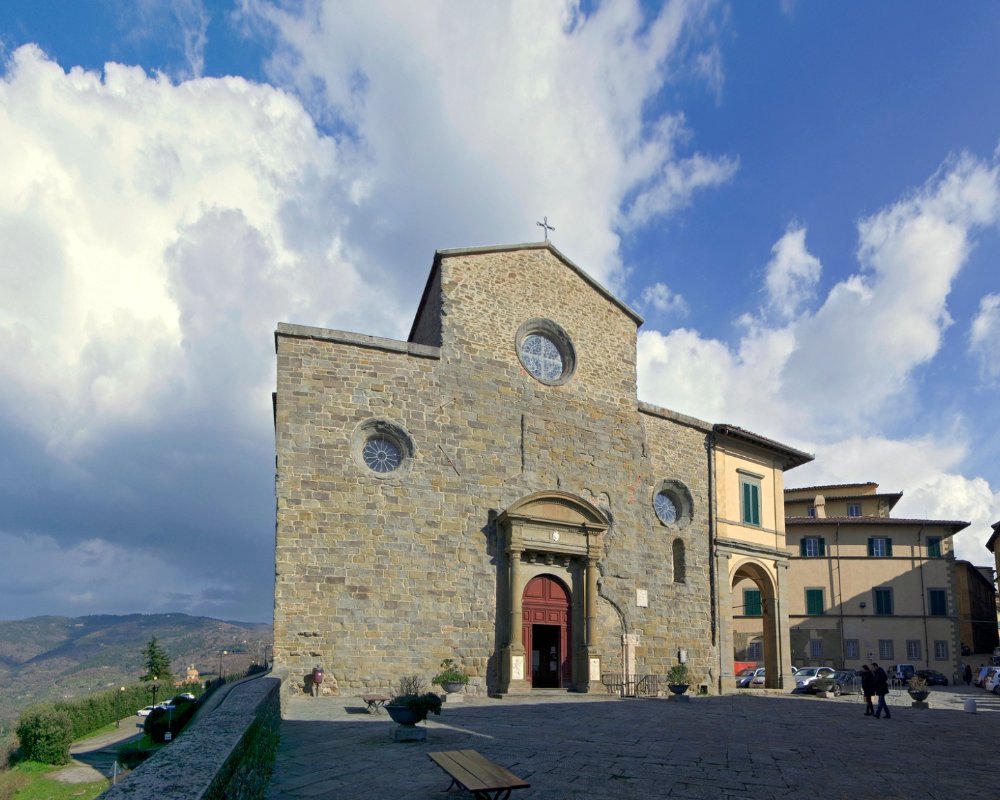
With the little town of Corezzo behind us, we descend to the provincial road and take the mule track to the village of Frassineta, then continue to Casa Santicchio, where you can sleep and eat. Proceed along the ancient road, which dives into the middle of a forest, and then you pass through the village of Pezza and its distinctive fountain, before ticking off Giona, Banzena, Caselle and then Campi, which Abbot Albert mentions as a good place for a break. The route goes on towards the medieval villages of Sarna and Rosina, and once past the “fountain of rusty waters”, we reach the centre of Chitignano.
With the little town of Corezzo behind us, we descend to the provincial road and take the mule track to the village of Frassineta, then continue to Casa Santicchio, where you can sleep and eat. Proceed along the ancient road, which dives into the middle of a forest, and then you pass through the village of Pezza and its distinctive fountain, before ticking off Giona, Banzena, Caselle and then Campi, which Abbot Albert mentions as a good place for a break. The route goes on towards the medieval villages of Sarna and Rosina, and once past the “fountain of rusty waters”, we reach the centre of Chitignano.
- straighten
Length25,7 km
- trending_down
Descent1150 m
- trending_up
Ascent970 m
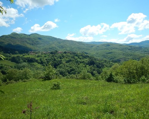
We leave Chitignano and go to have a look at the Ubertini Castle before getting back on the road: asphalt for the moment, but without much traffic. The route follows the Talla stream and comes to the Castle of Valenzano, which was built at the end of the ninth century for the purpose of a watchtower, but which now serves as a period country villa. The route ploughs on through woods and fields until reaching Subbiano, also known as the gate of Casentino, which sits on the left bank of the Arno.
We leave Chitignano and go to have a look at the Ubertini Castle before getting back on the road: asphalt for the moment, but without much traffic. The route follows the Talla stream and comes to the Castle of Valenzano, which was built at the end of the ninth century for the purpose of a watchtower, but which now serves as a period country villa. The route ploughs on through woods and fields until reaching Subbiano, also known as the gate of Casentino, which sits on the left bank of the Arno.
- straighten
Length18,6 km
- trending_down
Descent750 m
- trending_up
Ascent440 m
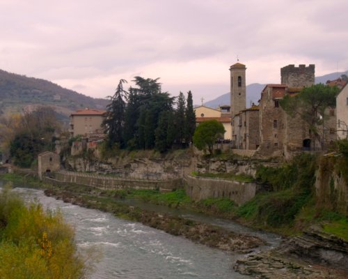
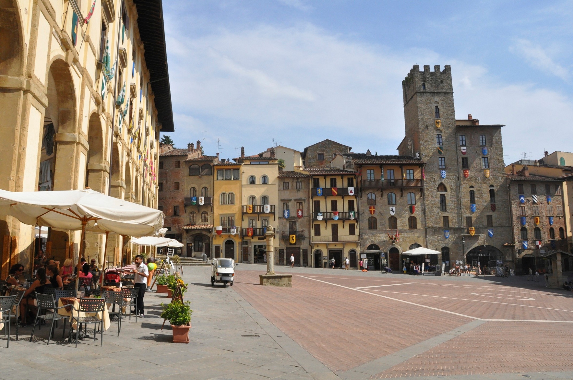
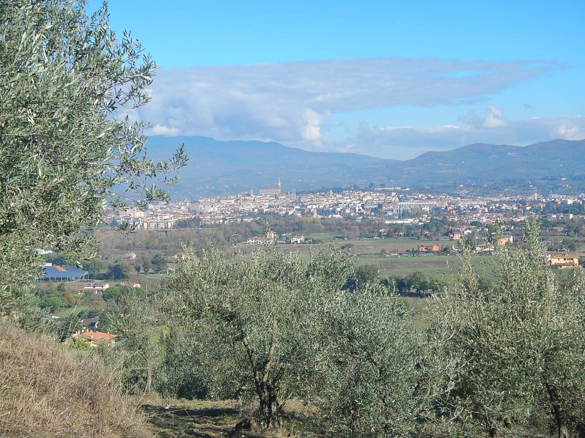
From Subbiano, the Via Romea Germanica hugs the Arno until it reaches Pieve a Sietina, which owes its name to the temple that the Etruscans built there in honour of their god Satres (Saturn). The old Romanesque church is home to frescoes from the fourteenth century and later. The route takes you through the Aretine countryside all the way to Arezzo, one of the great Etruscan lucumonia and subsequently a strategically important Roman base. At the heart of the city is Piazza Grande, ringed with magnificent palazzi like the Palazzo delle Logge, with its charming ateliers under the colonnade.
From Subbiano, the Via Romea Germanica hugs the Arno until it reaches Pieve a Sietina, which owes its name to the temple that the Etruscans built there in honour of their god Satres (Saturn). The old Romanesque church is home to frescoes from the fourteenth century and later. The route takes you through the Aretine countryside all the way to Arezzo, one of the great Etruscan lucumonia and subsequently a strategically important Roman base. At the heart of the city is Piazza Grande, ringed with magnificent palazzi like the Palazzo delle Logge, with its charming ateliers under the colonnade.
- straighten
Length20,3 km
- trending_down
Descent390 m
- trending_up
Ascent410 m
The route leaves Piazza Grande and Arezzo and takes you to the Sanctuary of Santa Maria delle Grazie, which has a beautiful portico inspired by that of Brunelleschi’s Spedale degli Innocenti in Florence. This leg of the Via Romea Germanica penetrates the Valdichiana under cover of extensive woodland, which is dotted with castles and country churches, and an ancient road; so ancient, in fact, that it is said to have been the road that Hannibal took on the march to the battle of Lake Trasimeno. You come to the parish church in Sassaia, which was built around the year 1000 and today is used as a guest house for pilgrims.
The route leaves Piazza Grande and Arezzo and takes you to the Sanctuary of Santa Maria delle Grazie, which has a beautiful portico inspired by that of Brunelleschi’s Spedale degli Innocenti in Florence. This leg of the Via Romea Germanica penetrates the Valdichiana under cover of extensive woodland, which is dotted with castles and country churches, and an ancient road; so ancient, in fact, that it is said to have been the road that Hannibal took on the march to the battle of Lake Trasimeno. You come to the parish church in Sassaia, which was built around the year 1000 and today is used as a guest house for pilgrims.
- straighten
Length17,5 Km
- trending_down
Descent441 m
- trending_up
Ascent511 m
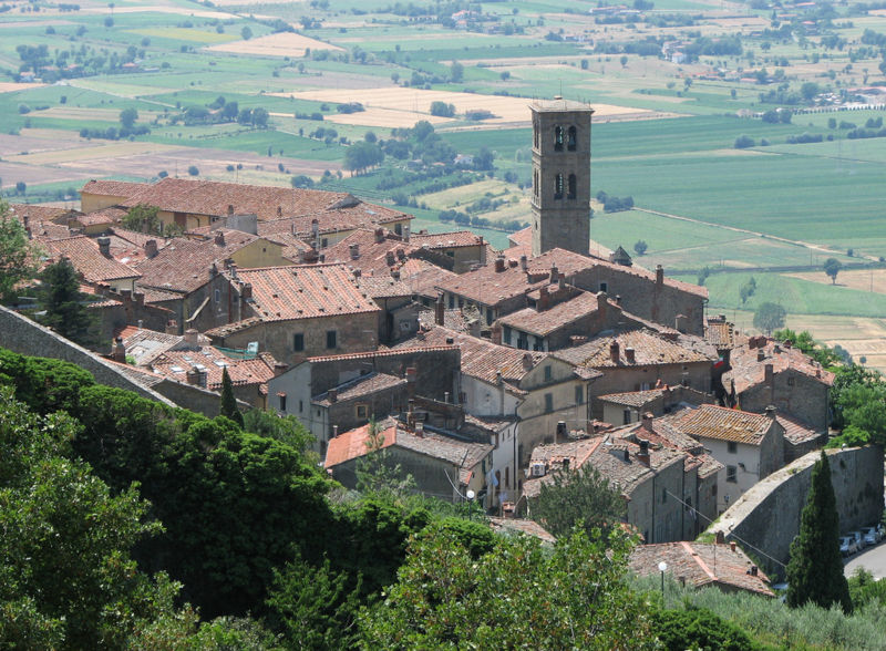
From the parish church/refuge of Sassaia the route descends in the direction of Castiglion Fiorentino, a medieval hilltown with an Etruscan heart. Its places to visit include a sixteenth-century loggia opposite the town hall: a balcony of the finest architecture, it offers a wondrous panorama over the valley. After Castiglion Fiorentino, the path continues to wind through the sublime vistas of the Valdichiana until it comes to Cortona, a city of Etruscan origins and a wealth of museums and artworks. It is certainly worth visiting the museum of the Accademia Etrusca and the archaeological park; the Diocesan Museum is also of note, thanks not least to an Annunciation by Beato Angelico.
From the parish church/refuge of Sassaia the route descends in the direction of Castiglion Fiorentino, a medieval hilltown with an Etruscan heart. Its places to visit include a sixteenth-century loggia opposite the town hall: a balcony of the finest architecture, it offers a wondrous panorama over the valley. After Castiglion Fiorentino, the path continues to wind through the sublime vistas of the Valdichiana until it comes to Cortona, a city of Etruscan origins and a wealth of museums and artworks. It is certainly worth visiting the museum of the Accademia Etrusca and the archaeological park; the Diocesan Museum is also of note, thanks not least to an Annunciation by Beato Angelico.
- straighten
Length21,7 Km
- trending_down
Descent468 m
- trending_up
Ascent598 m
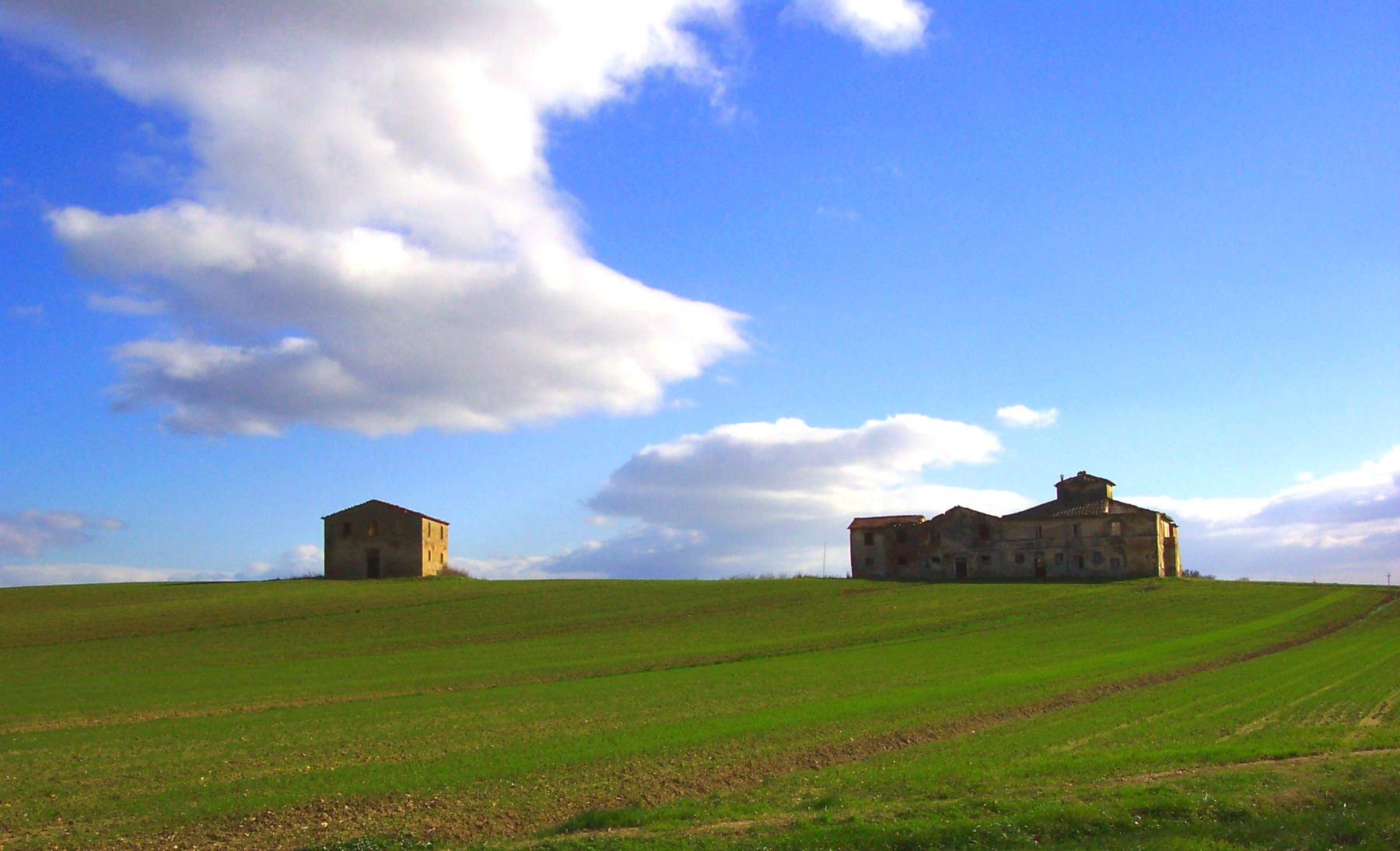
Leave Cortona’s central square and go down to the foot of the hill, where you will find the parish church of San Michele Arcangelo: originally an Arian church, it was rebuilt in the twelfth century. In this, the final Tuscan tract of the Via Romea Germanica, you cross the border into Umbria through wide open spaces and approach Lake Trasimeno. But before that, you reach the medieval hilltown of Pozzuolo, around eight kilometres from Castiglion del Lago.
Leave Cortona’s central square and go down to the foot of the hill, where you will find the parish church of San Michele Arcangelo: originally an Arian church, it was rebuilt in the twelfth century. In this, the final Tuscan tract of the Via Romea Germanica, you cross the border into Umbria through wide open spaces and approach Lake Trasimeno. But before that, you reach the medieval hilltown of Pozzuolo, around eight kilometres from Castiglion del Lago.
- straighten
Length25,1 km
- trending_down
Descent320 m
- trending_up
Ascent180 m
More info on the Via Romea Germanica site