
Discovering the “Terre della Luna”
The Lunigiana is a stretch of Tuscany with a DNA all its own, where you can find a blend of the scents and waters of the sea and the fragrances and colours of the Apennines. Here, in the area that takes its name from the luna, or moon, the sacred and the profane recall a bygone past. Malaspina castles, Romanesque parish churches and Renaissance palaces guide you as you trace the course of history and explore the lively and dynamic Lunigiana, where the star of the show is the taste of the best local dishes from the Valle del Magra, like testaroli and focaccette, known as panigacci around these parts.
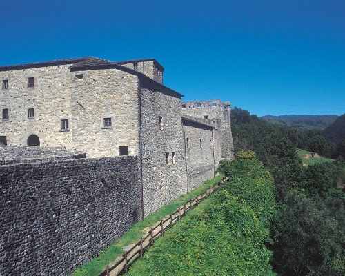
The essence of the Lunigiana can be seen in its most primitive element: stone. The stele statues, capitals of the Romanesque parish churches, crenelated castle walls, modest walls of the rural towns, the mysterious faciòn and objects of everyday use and work are just some of the symbols of the Valle della Luna. And all of them depend on her, sandstone, a poor stone compared to what can be found in the nearby Apuan Alps, but which didn’t disfigure the environment or need to be extracted. Here, the rock was wounded only by simple and ancient tools, guided by patient hands with the skill to create graceful figures, like those decorating the splendid capitals of the parish churches of SS. Cipriano e Cornelio in Codiponte, S. Paolo in Vendaso and S. Stefano di Sorano in Filattiera, where even the “sacred” stone lives side-by-side with the “profane” stone of the stele statues. These Pagan idols made by the Ligurian-Apuani, up to a metre and a half tall, are archaic representations of human figures that, based on the weapons they are holding, amulets they are wearing and the evolution of the somatic lines, can be dated to a period between the Copper Age and the late Iron Age. More than 50 of these anthropomorphic figures are housed in the Piagnaro Castle, in the celebrated “Museum of the Lungiana Stele Statues”. And it’s precisely in Pontremoli where we begin our journey.
Begin your tour around the historic centre of Pontremoli at Porta Parma. The village clasps to the slope dominated by the Piagnaro Castle, an integral part of the defense wall and towers erected to protect the town. The medieval castle is home to the Museum of the Lungiana Stele Statues, which hosts a collection of 50 anthropomorphic figures, stone effigies that have become the Lunigiana’s ambassadors to the world. The stele statues are the first significant expressions of the art, technique and religious beliefs of the communities that lived in the valley from the Copper Age to Antiquity.
Continuing along via Garibaldi, step after step you’ll discover medieval houses, opulent Baroque buildings, the stillness of the stones used to construct ancient bridges, frescoes decorating the churches and historic paved streets enlivened by the colours and scents on full display for tourists. The Church of Santa Maria del Popolo, today’s cathedral, stands in piazza della Repubblica, a testament to the excellent economic development that took place in the 17th and 18th centuries. With the explosion of the Baroque style, the town was redesigned, the churches embellished and the old houses knocked down to make way for new noble palaces.
The Pavesi, Bocconi, Damiani and Petrucci palaces and the Teatro della Rosa were all built in the Baroque period of prosperity, with the help of artists called upon to decorate religious buildings and private palaces. Carry on down via Cavour, then turn left towards Ponte C. Battisti, the Castelnuovo tower and the Baroque Church of Nostra Donna. Heading down via Giuseppe Mazzini, stone inspires a theological and philosophical examination through the “labyrinth of faith”: a medieval low-relief on a slab of sandstone, preserved in the Church of San Pietro, depicting the complexity of the physical and spiritual walk toward salvation. On this route retracing the mix of different cultures, passed by and morphed like the water of the River Magra flowing nearby, you’ll come to the Church of Santissima Annunziata, where there is an evocative font of holy water boasting a depiction in the round of the Virgin Annunciate.
In July, the city hosts one of the most important literary events on a national level, the “Premio Bancarella,” which each year in Pontremoli celebrates readers’ taste by nominating books that have remained, and will always remain, in the collective imagination, beginning with The Old Man and the Sea, which won Hemingway the award in 1952.
From Pontremoli, which takes its name from “Ponte Tremolus,” a shaky medieval bridge over the River Magra, head in the direction of Aulla along the SS62 della Cisa: the hike will begin in the town of Pala (bus stop, sign for the Via Francigena). Moving to the left, toward Canale, you can admire a beautiful stone bridge, the town’s church and a series of rural buildings nestled amongst the greenery. Continuing down the asphalt road, you’ll come to Ponticello, a small stone village from where a dirt track begins that runs through the forest after crossing the Caprio stream.
In the nearby Parish Church of Santo Stefano di Sorano (11th century), the medieval via Francigena has left traces of a mix of Tuscan and Lombard Romanesque, blended together and highlighted in the monumental and evocative apses, while a stele statue can be seen set into the presbytery. Filattiera can be spotted above, a Byzantine fortification and castle, where the Spino Fiorito branch of the Malaspina family once lived. Head to the left, toward the medieval village, and leave the woods from the eastern side, following the CAI 132 path down toward the Monia stream; keeping to the right bank, cross the Ghiara and Piano canals. Pick up the asphalt road again to reach Filetto, home to dazzling corner towers and piazza del Pozzo. The adorable, four-sided village, surrounded by an ancient forest of chestnut trees, is famous for its antiques markets and medieval re-enactments.
Exiting the town through the defense wall, take the road that leads quickly to Villafranca in Lunigiana, where the Francigena used to pass. When the rushing stream and the distance between its banks didn’t allow for a stone bridge to be built, crossing the water was only allowed for rafts, for a fee of course. This was the case in Villafranca in Lunigiana: the chain used for ferrying from one side of the Magra to the other is today preserved in the Ethnographical Museum of Lunigiana, housed in an ex-water mill. Objects of everyday use and artisan crafts, organized by theme and work cycle, are brought together in the museum’s rooms, offering a comprehensive summary of the local culture of the Lunigiana and rural society. Return to Pontremoli – or Pala – with the bus line.
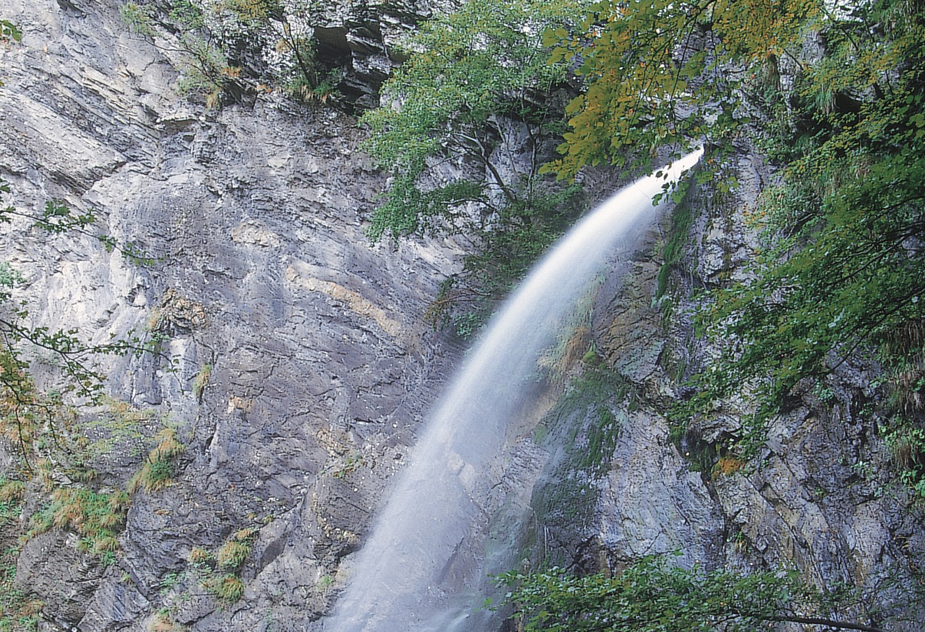
In Valdantena, to the south of the Passo della Cisa and Passo del Cirone, the Magra is a fresh, clean stream; its course begins 62 kilometres before the Ligurian Sea, when it’s still a brook, making a spectacular leap at the Piscio di Pràcchiola. The site can be reached from Pontremoli via the SS62 della Cisa, in the direction of Mignegno.
Passing by the residential centre, take the Cirone provincial road (SP42) and climb up the Valdantena to Pràcchiola (15.4 km); a few hundred meters before, from the bridge, you can see a deep chasm that the Magra dug into the layers of Pràcchiola sandstone. The hiking trail crosses through the town and flanks the left side of the Magra all the way to the waterfall (45 minutes).
After a brief walk, go by car toward Pontremoli until you reach a crossroads for Logarghena: turn left and pass by Versola, Toplecca di Sotto, Toplecca di Sopra and La Piagna, where the asphalt road ends and the unpaved road begins. After about 4 km, at the crossroads for the “Enrico Mattei” refuge (1,140 m), park your car and head to the left. The Logarghena meadows are a must for anyone going in the direction of the refuge, offering a beautiful mountain view of extensive pastures framed by the peaks of the Tosco-Emiliano Apennines and embellished in the spring by the stunning narcissuses and orchids that blossom here in the month of May. After the brief hike, return to Pontremoli along provincial road n. 35, making a full circle.
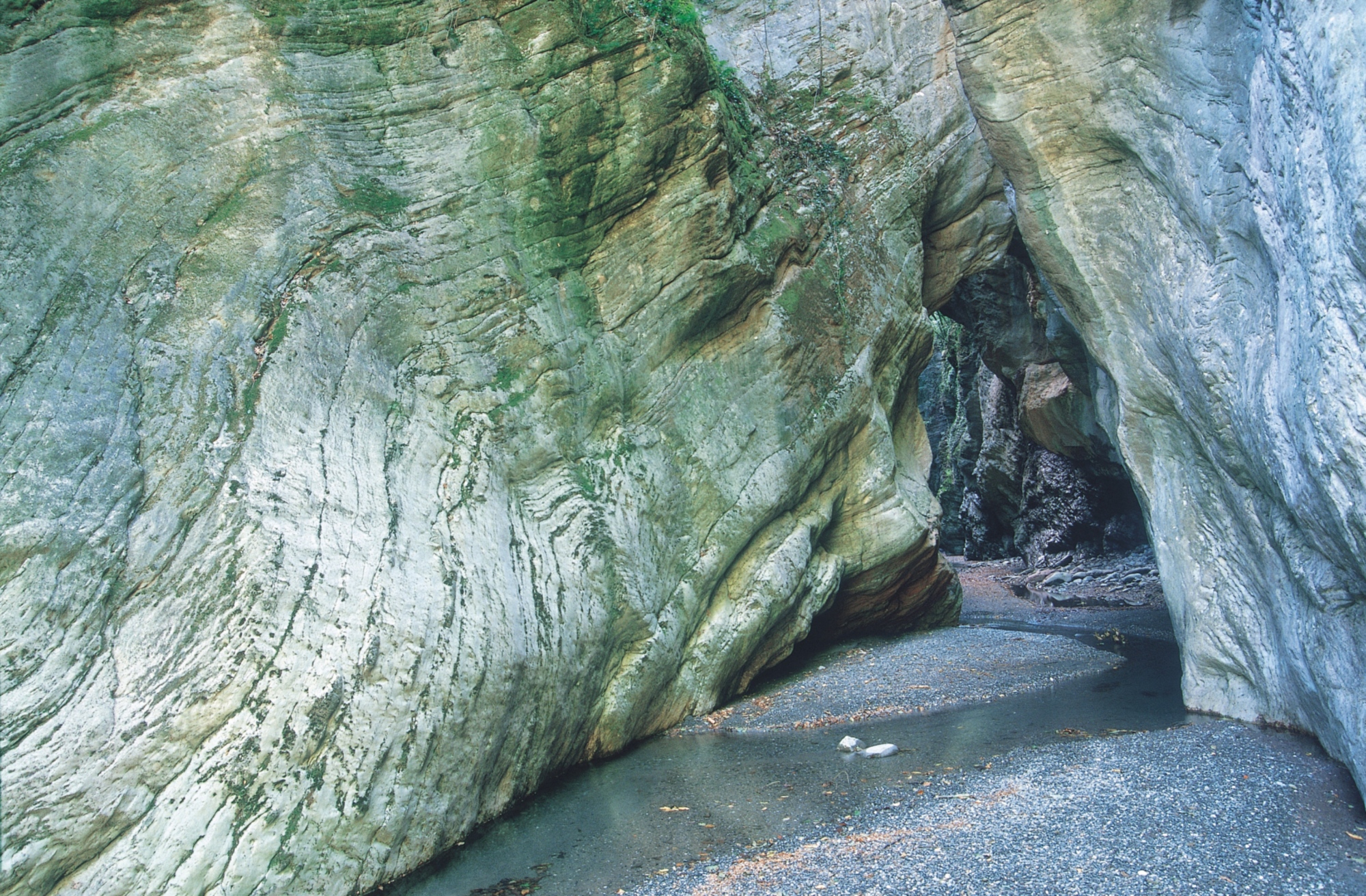
In the Lunigiana, nature is full of surprises: in the Valle del Gordana, climbing the stony bank of the namesake creak, a narrow and tall river gorge suddenly rises up, where the water, relentlessly eroding the rock face over the centuries, has formed a geological marvel. The Stretti di Giaredo, a Site of Community Importance (SIC), can be reached from Pontremoli along provincial road n. 37 toward Zeri: once past the viaduct on the A15, in just a few kilometres, the road for Vallelunga, Cavezzana and Gordana (3.5 km) will appear on the left.
Before getting to Casa Serati, on the right, an unpaved road will end around the Giaredo meadows and the Gordana steam (1 km). Once you’ve parked the car, the Stretti can be reached in 5-10 minutes; you can climb up the spectacular canyon for almost 2 kilometres, walking and swimming in the waterfalls, cascades and evocative ponds. We wouldn’t recommend adventuring into the gorge in the spring, autumn and winter.
When you’re done hiking, head back in the direction of Pontremoli via the SP37 toward the Zeri valley, where you’ll have another chance to be wowed by the artisan preparation and aging of the tasty and fragrant cheeses that are made from free-range Zerasca sheep, a breed beloved for the rustic quality and goodness of its young meat.
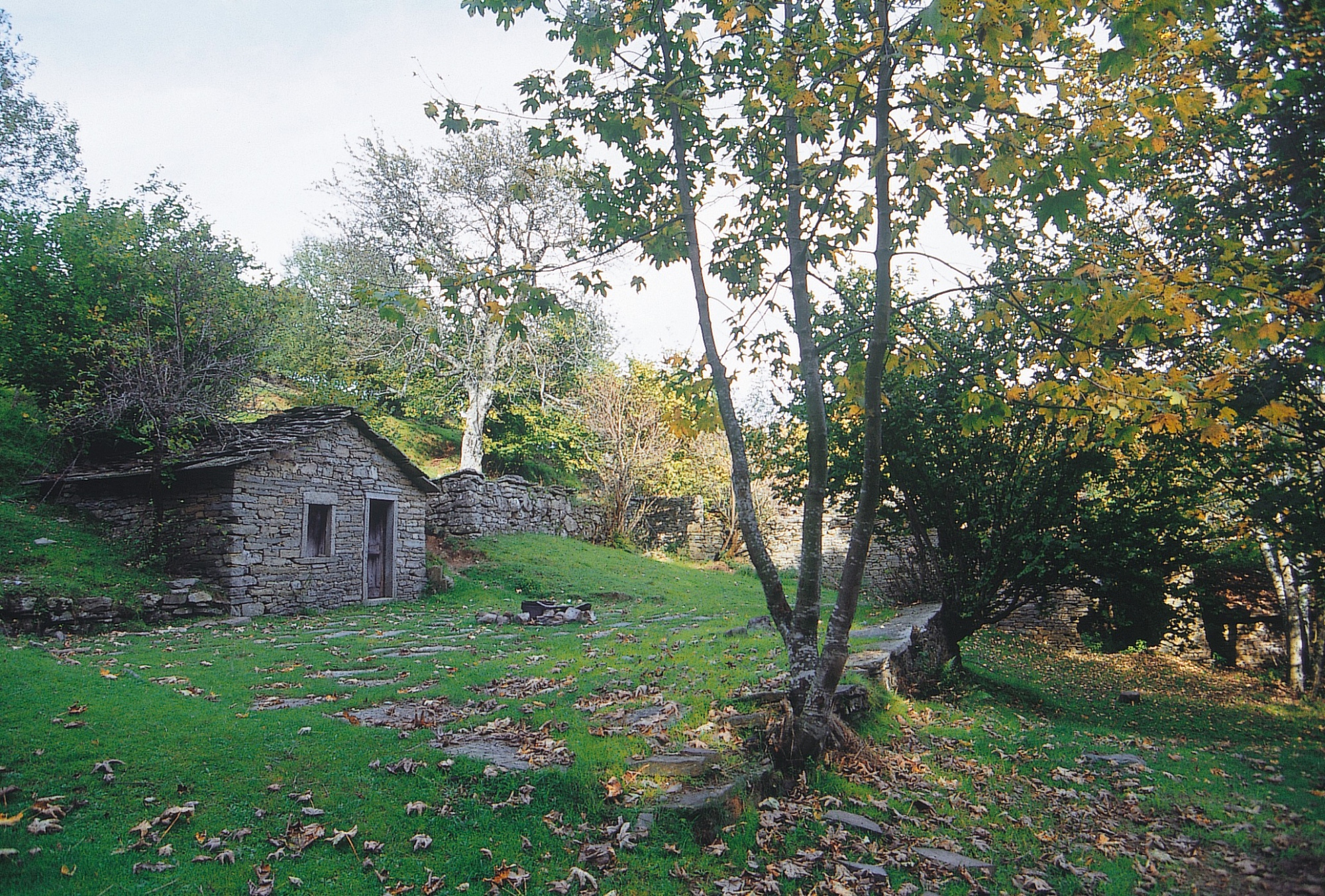
When you’ve reached Patigno, continue through Passo dei Due Santi: 2 kilometres from Zum Zeri, alongside a hairpin turn, just before the crossroads for Villaggio Aracci, take the road to the right for about 100 metres, after which you can park the car and continue on foot along a dirt trail that heads down to the abandoned village of Formentara, comprising about 20 buildings whose designs were strongly influenced by farming needs and the presence of animals. The houses are divided into two parts: the ground floor, where the animals would be kept, and the upper floor, accessible from above, which was used as the living space. After the short hike, return to Pontremoli.
In the Lunigiana, nature is full of surprises: in the Valle del Gordana, climbing the stony bank of the namesake creak, a narrow and tall river gorge suddenly rises up, where the water, relentlessly eroding the rock face over the centuries, has formed a geological marvel. The Stretti di Giaredo, a Site of Community Importance (SIC), can be reached from Pontremoli along provincial road n. 37 toward Zeri: once past the viaduct on the A15, in just a few kilometres, the road for Vallelunga, Cavezzana and Gordana (3.5 km) will appear on the left.
Before getting to Casa Serati, on the right, an unpaved road will end around the Giaredo meadows and the Gordana steam (1 km). Once you’ve parked the car, the Stretti can be reached in 5-10 minutes; you can climb up the spectacular canyon for almost 2 kilometres, walking and swimming in the waterfalls, cascades and evocative ponds. We wouldn’t recommend adventuring into the gorge in the spring, autumn and winter.
When you’re done hiking, head back in the direction of Pontremoli via the SP37 toward the Zeri valley, where you’ll have another chance to be wowed by the artisan preparation and aging of the tasty and fragrant cheeses that are made from free-range Zerasca sheep, a breed beloved for the rustic quality and goodness of its young meat.
When you’ve reached Patigno, continue through Passo dei Due Santi: 2 kilometres from Zum Zeri, alongside a hairpin turn, just before the crossroads for Villaggio Aracci, take the road to the right for about 100 metres, after which you can park the car and continue on foot along a dirt trail that heads down to the abandoned village of Formentara, comprising about 20 buildings whose designs were strongly influenced by farming needs and the presence of animals. The houses are divided into two parts: the ground floor, where the animals would be kept, and the upper floor, accessible from above, which was used as the living space. After the short hike, return to Pontremoli.
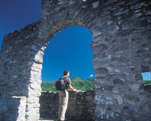
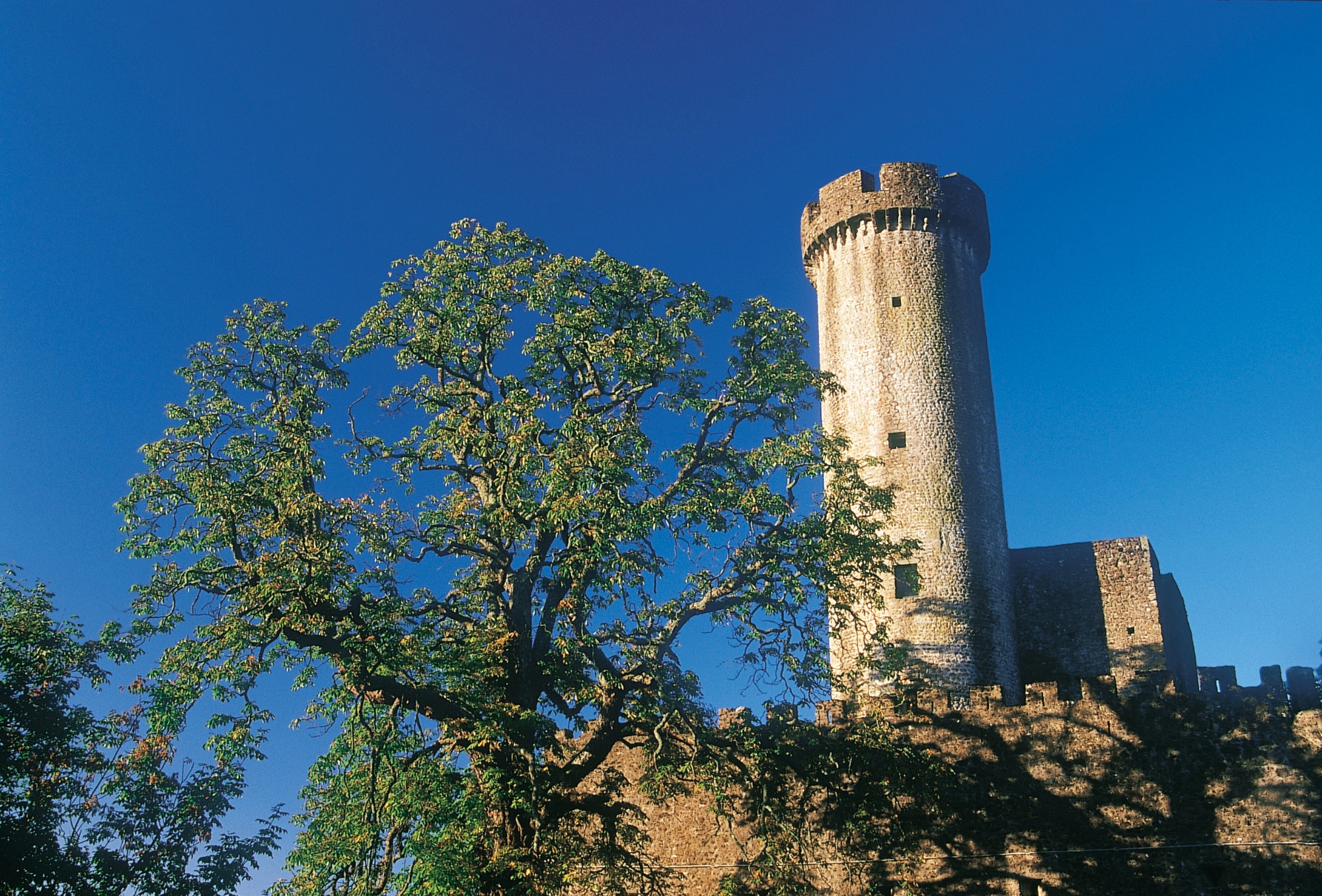
From Pontremoli, take the SS62 in the direction of Aulla until you come to the crossroads with the SP29, where the village of Bagnone appears, built atop a series of evocative cascades and dominated by the Malaspina Castle. Even the most distracted tourist will notice the 14th-century Malgrate Castle, boasting a splendid circular tower crowned by brackets and the small village that seems to complete it.
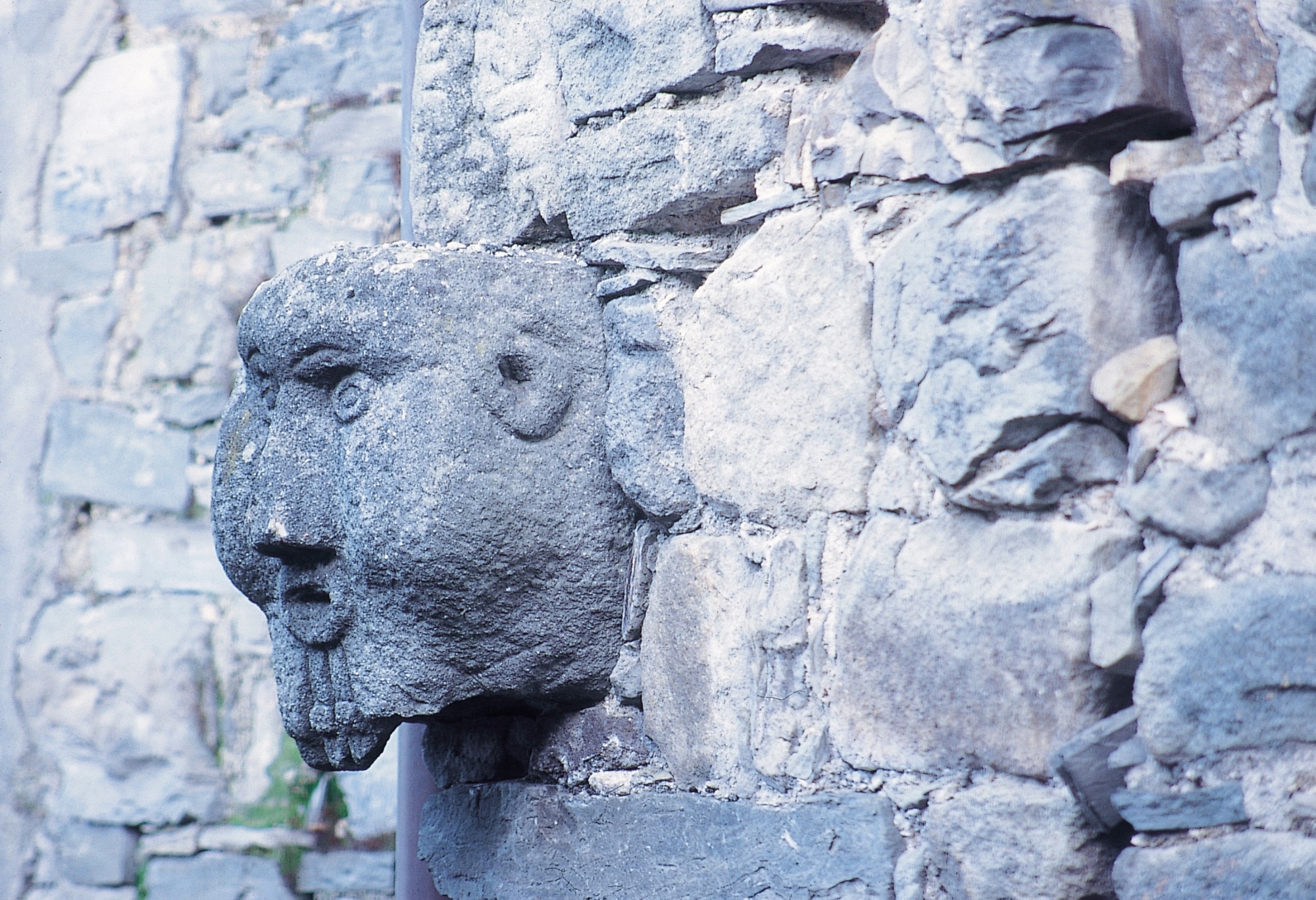
Climbing up the road, Bagnone will appear with its fortress and portico leading into the centre, separated by the namesake creak: along the historic roads, you can discover the faciòn with grotesque faces that were placed on the doors of homes as a way to ward off evil spirits. Continue on the hilly SP21, passing through the hamlets of Gabbiana, Lusana and Villa di Panicale to arrive in Licciana Nardi, home to a castle, medieval walls and the Church of Santi Giacomo e Cristoforo.
You can reach Comano from Licciana Nardi, at the foot of the Tosco-Emiliano Apennines. Begin the hike toward Camporàghena (up 880 metres, 6 hours total) from the castle (530 m): walk upward in the shade of a chestnut forest until you reach a crossroads; ignoring the deviation to the left that leads to the town of Sommocomano, head down an ancient, cobblestoned mule track. After crossing the Fiascone stream, continue the steep path that leads up to the Montefiascone meadows, flanking the slopes of Monte Rozzo to the left. When you reach a pass in a large, open area, descend back down to the right toward the forest and the Ragadoni canal. The road now offers a suggestive view of the imposing terrace of the Groppi di Camporàghena.
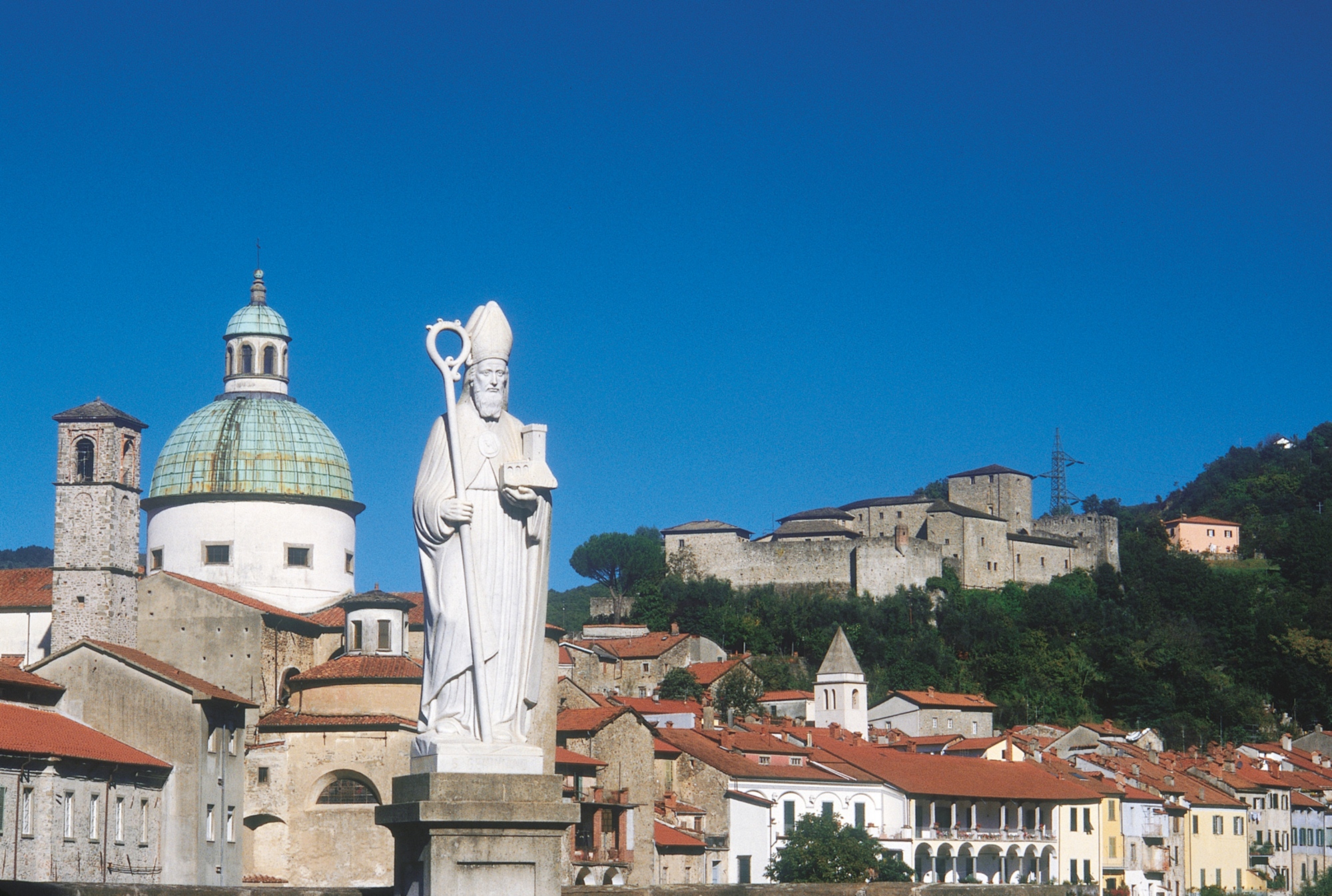
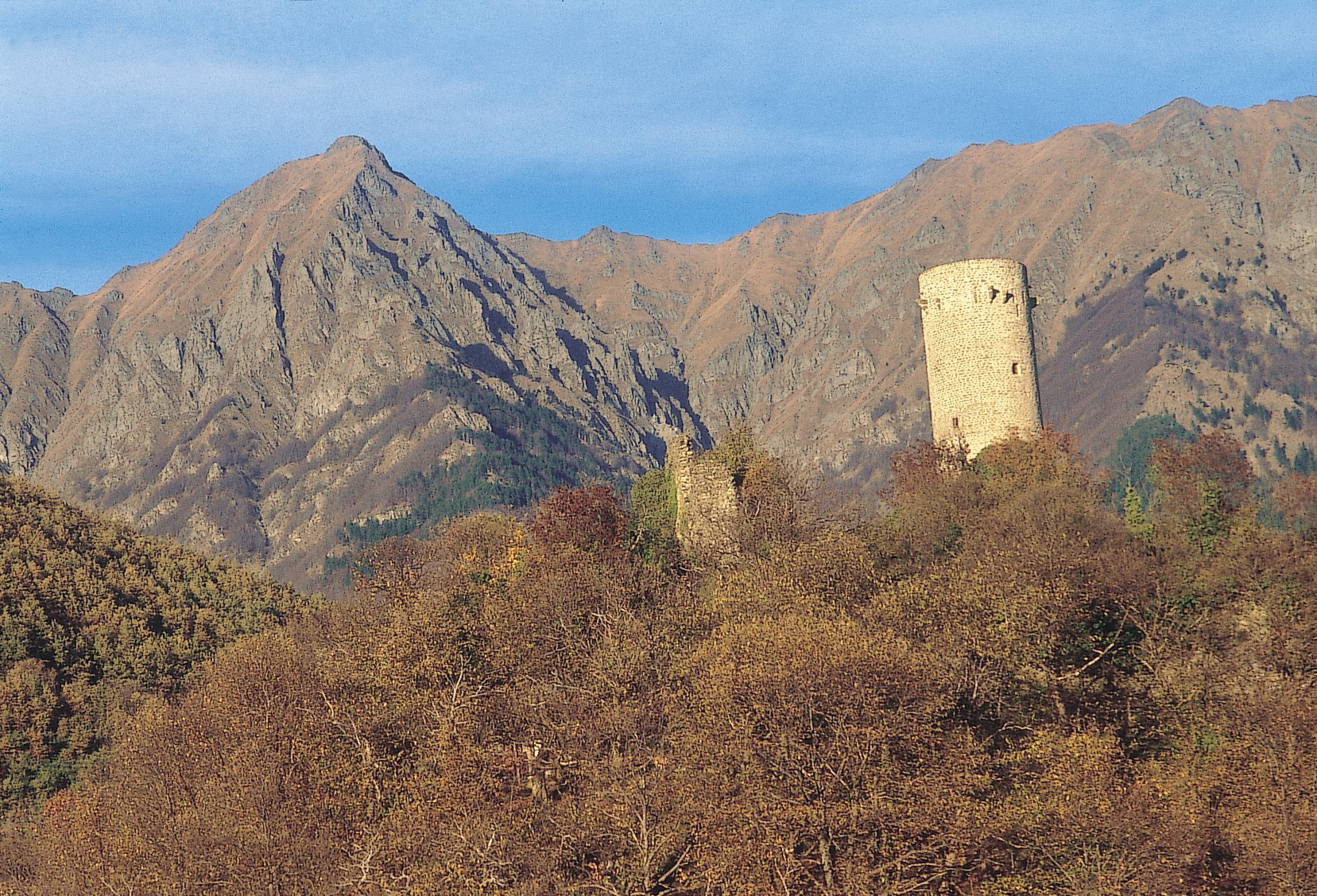
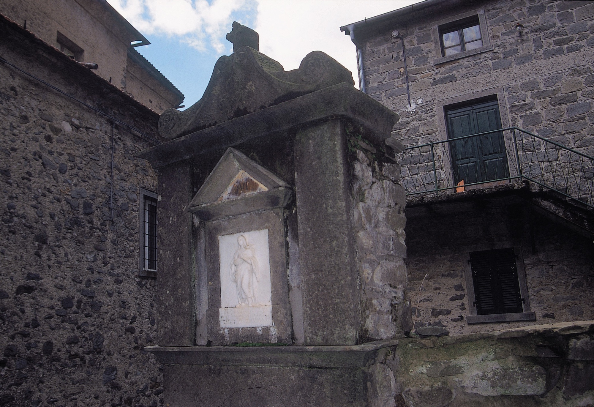
Halfway up, continue toward the Luscignano stream, making sure to keep to the left; once you’ve crossed the stream, the mule track will also lead you past the Paleroso stream before reaching the Torsana cemetery (936 m). Go past the Church of San Giacomo and descend the ancient mule track to “touch” the Camporàghena Castle and the Church of SS Pietro e Paolo; you’ll eventually come to Camporàghena, a well-preserved village built along the road that connects Comano to Sassalbo and to Passo del Cerreto. Camporàghena is home to curious rural sculptures dating to before the 17th century, made up of faces, doors, stone fountains and maestà, the last of which are marble low-reliefs that can be found all throughout the Lunigiana, on ancient paths through the forests and within city centres, as is the case with the beautiful example located in a votive niche in Camporàghena. The day ends in Aulla, home of the Abbey of San Caprasio, one of the most important monastic centres in medieval Lunigiana. You can’t miss a visit to the austere and mighty Brunella Fortress, where the Museum of Natural History is located, educating visitors about the most important aspects of the Lunigiana’s environment.
From Pontremoli, take the SS62 in the direction of Aulla until you come to the crossroads with the SP29, where the village of Bagnone appears, built atop a series of evocative cascades and dominated by the Malaspina Castle. Even the most distracted tourist will notice the 14th-century Malgrate Castle, boasting a splendid circular tower crowned by brackets and the small village that seems to complete it.
Climbing up the road, Bagnone will appear with its fortress and portico leading into the centre, separated by the namesake creak: along the historic roads, you can discover the faciòn with grotesque faces that were placed on the doors of homes as a way to ward off evil spirits. Continue on the hilly SP21, passing through the hamlets of Gabbiana, Lusana and Villa di Panicale to arrive in Licciana Nardi, home to a castle, medieval walls and the Church of Santi Giacomo e Cristoforo.
You can reach Comano from Licciana Nardi, at the foot of the Tosco-Emiliano Apennines. Begin the hike toward Camporàghena (up 880 metres, 6 hours total) from the castle (530 m): walk upward in the shade of a chestnut forest until you reach a crossroads; ignoring the deviation to the left that leads to the town of Sommocomano, head down an ancient, cobblestoned mule track. After crossing the Fiascone stream, continue the steep path that leads up to the Montefiascone meadows, flanking the slopes of Monte Rozzo to the left. When you reach a pass in a large, open area, descend back down to the right toward the forest and the Ragadoni canal. The road now offers a suggestive view of the imposing terrace of the Groppi di Camporàghena.
Halfway up, continue toward the Luscignano stream, making sure to keep to the left; once you’ve crossed the stream, the mule track will also lead you past the Paleroso stream before reaching the Torsana cemetery (936 m). Go past the Church of San Giacomo and descend the ancient mule track to “touch” the Camporàghena Castle and the Church of SS Pietro e Paolo; you’ll eventually come to Camporàghena, a well-preserved village built along the road that connects Comano to Sassalbo and to Passo del Cerreto. Camporàghena is home to curious rural sculptures dating to before the 17th century, made up of faces, doors, stone fountains and maestà, the last of which are marble low-reliefs that can be found all throughout the Lunigiana, on ancient paths through the forests and within city centres, as is the case with the beautiful example located in a votive niche in Camporàghena. The day ends in Aulla, home of the Abbey of San Caprasio, one of the most important monastic centres in medieval Lunigiana. You can’t miss a visit to the austere and mighty Brunella Fortress, where the Museum of Natural History is located, educating visitors about the most important aspects of the Lunigiana’s environment.