
Discovering an ancient connection with the Via Francigena, from Florence to Siena
For the connections with Rome, the Florentines used the Via Sanese: it was the shortest way to get from Florence to Siena. The itinerary alternates between stretches on secondary paved roads and dirt roads, also crossing the official route of the Via Francigena.
Four stopovers cross the Florentine and Sienese countryside to discover parish churches, abbeys and medieval villages. A journey that starts from Piazza della Santissima Annunziata in Florence and touches places steeped in history such as Sant'Andrea in Percussina, San Casciano in Val di Pesa, Badia a Passignano, San Donato in Poggio, Castellina in Chianti, until you reach Siena in the Basilica of San Francesco.
Brief history of Via Sanese
In the first part of its itinerary (from Florence to the bottom of the valley of the Pesa) the road coincided with the track of another of the main roads of the Florentine countryside, the one that will be later called Strada Regia Romana, which reached the Francigena in Poggibonsi, in the central valley of the Elsa, continuing then, but with a slightly longer route, towards Siena.
During the 13th Century, with the development of the trans-Apennines road to Bologna, the Roman pilgrims, favoring the crossings of the Mugello instead of Passo della Cisa, turned Florence into a compulsory stopping point on the way to Rome. The Via Sanese thus played an increasingly important role in the framework of the system of pilgrimage routes.
The first part of the walk crosses from north to south the historic town center of Florence. An urban itinerary that starts from Piazza della Santissima Annunziata, where the Basilica of the same name and the Spedale degli Innocenti are located, and touches some of the most charming locations of the city: the Spedale di Santa Maria Nuova, the Cathedral of Santa Maria del Fiore, Piazza della Signoria and Palazzo Vecchio, the Uffizi Gallery, Ponte Vecchio, until you reach Porta San Miniato, which marks the beginning of the route outside the walls. Once Poggio Imperiale is reached, one continues towards the Romanesque church of San Felice a Ema and takes the old road to Pozzolatico.
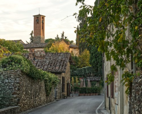
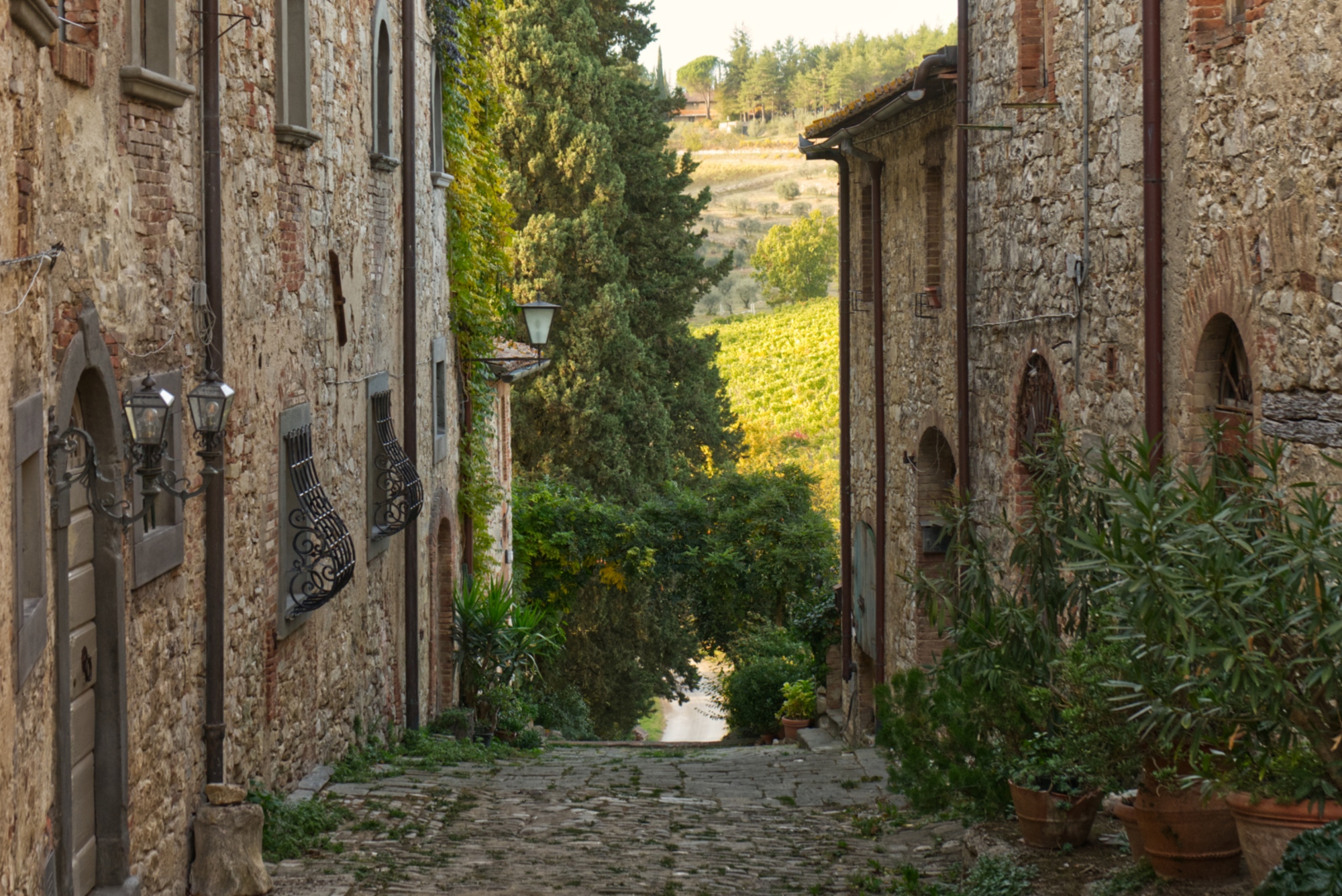
Set deep in the hills of the Florentine countryside, among farmhouses and olive groves, you arrive at Tavarnuzze and continue to climb towards Sant'Andrea in Percussina, where you will find the Albergaccio, which was the home of Niccolò Machiavelli during his exile from Florence. A few more kilometers of road and you reach San Casciano in Val di Pesa, a resting place since Roman times and an important military outpost to protect Florence. Today its historic town center is enriched by important works and installations of contemporary art; in the church of Santa Maria del Prato is kept a wooden crucifix by Simone Martini.
The first part of the walk crosses from north to south the historic town center of Florence. An urban itinerary that starts from Piazza della Santissima Annunziata, where the Basilica of the same name and the Spedale degli Innocenti are located, and touches some of the most charming locations of the city: the Spedale di Santa Maria Nuova, the Cathedral of Santa Maria del Fiore, Piazza della Signoria and Palazzo Vecchio, the Uffizi Gallery, Ponte Vecchio, until you reach Porta San Miniato, which marks the beginning of the route outside the walls. Once Poggio Imperiale is reached, one continues towards the Romanesque church of San Felice a Ema and takes the old road to Pozzolatico.
Set deep in the hills of the Florentine countryside, among farmhouses and olive groves, you arrive at Tavarnuzze and continue to climb towards Sant'Andrea in Percussina, where you will find the Albergaccio, which was the home of Niccolò Machiavelli during his exile from Florence. A few more kilometers of road and you reach San Casciano in Val di Pesa, a resting place since Roman times and an important military outpost to protect Florence. Today its historic town center is enriched by important works and installations of contemporary art; in the church of Santa Maria del Prato is kept a wooden crucifix by Simone Martini.
- straighten
Length22 km
- schedule
Duration6 h
- trending_down
Descent482 m
- trending_up
Ascent739 m
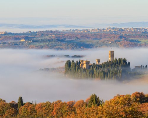
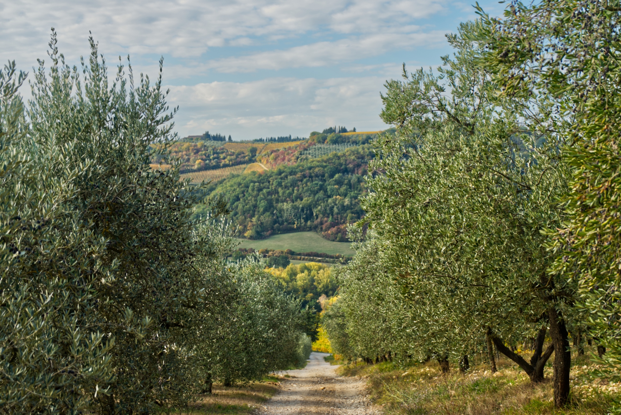
San Casciano is one of the gateways to Chianti Classico, perhaps the most famous landscape icon of Tuscany in the world. The path, after a short stretch on a paved road, follows the farmhouses which run along the vineyards as far as the village of Montefiridolfi. From here, continuing along hilly roads, you reach Santa Maria a Macerata and, after a stretch in the woods, Badia a Passignano, where the magnificent Benedictine abbey of San Michele Arcangelo is located. The abbey, likely built by the Longobards, was restored in the middle of the 11th Century by the abbot Leto, successor of San Giovanni Gualberto, the founder of the Congregation of Vallombrosa. The monastery, which still today keeps the mortal remains of the saint, soon became a pilgrimage destination and with the passing of the centuries, its structure grew to become a great complex of buildings, gathered within a thirteenth-century circle of walls. The Abbey and the surrounding territory are part of a protected natural area established in 2016.
San Casciano is one of the gateways to Chianti Classico, perhaps the most famous landscape icon of Tuscany in the world. The path, after a short stretch on a paved road, follows the farmhouses which run along the vineyards as far as the village of Montefiridolfi. From here, continuing along hilly roads, you reach Santa Maria a Macerata and, after a stretch in the woods, Badia a Passignano, where the magnificent Benedictine abbey of San Michele Arcangelo is located. The abbey, likely built by the Longobards, was restored in the middle of the 11th Century by the abbot Leto, successor of San Giovanni Gualberto, the founder of the Congregation of Vallombrosa. The monastery, which still today keeps the mortal remains of the saint, soon became a pilgrimage destination and with the passing of the centuries, its structure grew to become a great complex of buildings, gathered within a thirteenth-century circle of walls. The Abbey and the surrounding territory are part of a protected natural area established in 2016.
- straighten
Length15,4 km
- schedule
Duration4 h
- trending_down
Descent300 m
- trending_up
Ascent330 m
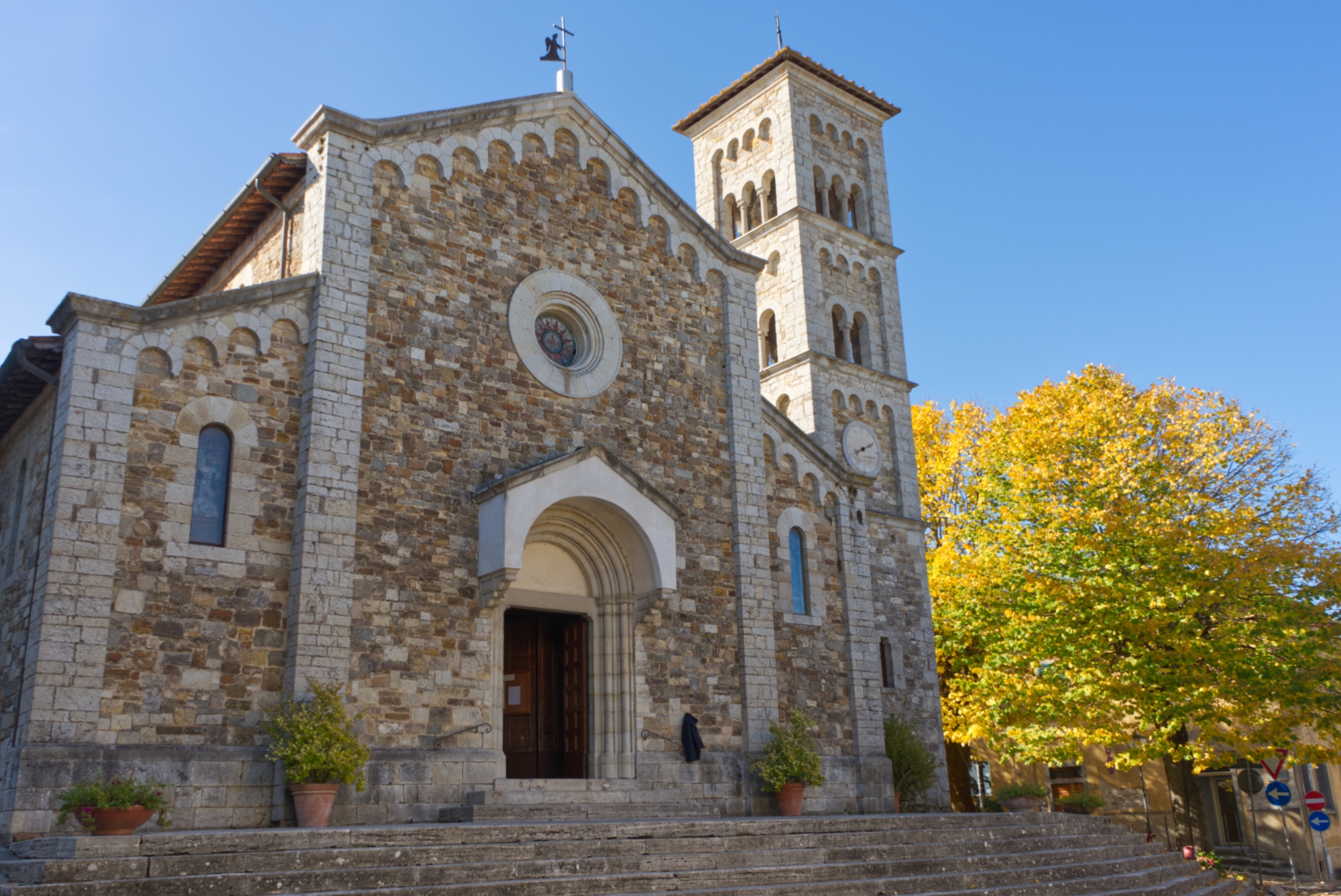
Leaving Badia a Passignano, you continue through the woods to the bottom of the valley in the direction of San Donato in Poggio, one of the main stopping points of the Sanese. The village preserves its medieval urban structure intact; outside the walls, there is the parish church of San Donato, which maintains the original architectural features and is one of the most important examples of Romanesque architecture in the Florentine countryside. After passing Madonna di Pietracupa and the Ricavo estate, you reach Castellina in Chianti where, before entering the historic town center, you find the Tumulo di Montecalvario, an imposing Etruscan sepulchral monument built at the end of the 7th Century B.C. Located in a strategic position on the ridge overlooking the Valdelsa and the surrounding areas, Castellina was an outpost of the Republic of Florence and, in the 15th Century, was equipped with powerful defensive works based on the projects by Giuliano da Sangallo and Filippo Brunelleschi. In the historic town center you find the Rocca, today seat of the Museo Archeologico del Chianti, the church of San Salvatore, restructured in neo-Romanesque style, the Via delle Volte, a charming, covered pedestrian passage. For centuries, the village has been an important stopping point on the way to Rome, on the border between the Sienese and Florentine sides.
Leaving Badia a Passignano, you continue through the woods to the bottom of the valley in the direction of San Donato in Poggio, one of the main stopping points of the Sanese. The village preserves its medieval urban structure intact; outside the walls, there is the parish church of San Donato, which maintains the original architectural features and is one of the most important examples of Romanesque architecture in the Florentine countryside. After passing Madonna di Pietracupa and the Ricavo estate, you reach Castellina in Chianti where, before entering the historic town center, you find the Tumulo di Montecalvario, an imposing Etruscan sepulchral monument built at the end of the 7th Century B.C. Located in a strategic position on the ridge overlooking the Valdelsa and the surrounding areas, Castellina was an outpost of the Republic of Florence and, in the 15th Century, was equipped with powerful defensive works based on the projects by Giuliano da Sangallo and Filippo Brunelleschi. In the historic town center you find the Rocca, today seat of the Museo Archeologico del Chianti, the church of San Salvatore, restructured in neo-Romanesque style, the Via delle Volte, a charming, covered pedestrian passage. For centuries, the village has been an important stopping point on the way to Rome, on the border between the Sienese and Florentine sides.
- straighten
Length21,1 km
- trending_down
Descent530 m
- trending_up
Ascent760 m
The protagonist of the leg is again the hilly landscape of Chianti, made of vineyards, olive groves and cultivated fields. Leaving Castellina behind, you arrive at the cypress forest of Sagna and, shortly after, at the charming village of Fonterutoli, where the castle of the same name once stood on the border between Florence and Siena. Towards the end of the 20th Century, at a short distance from the village, an Etruscan necropolis was discovered near Poggino. Once you leave the village, a short climb leads to an unpaved road that crosses the villages of Capanno, Casa Frassi and Casalino, until it reaches the Molino di Quercegrossa. After climbing up to the castle and leaving the village of Quercegrossa, you continue walking towards Uopini, where the Romanesque church of San Marcellino and Erasmo is located. By now at the gates of Siena, the path enters the urban area of the city, climbing up to the majestic outside gate of Camollia, where the path inside the walls begins. An itinerary that leads us to the discovery of the most fascinating places in the historic town center until the final destination, the Basilica of San Francesco.
The protagonist of the leg is again the hilly landscape of Chianti, made of vineyards, olive groves and cultivated fields. Leaving Castellina behind, you arrive at the cypress forest of Sagna and, shortly after, at the charming village of Fonterutoli, where the castle of the same name once stood on the border between Florence and Siena. Towards the end of the 20th Century, at a short distance from the village, an Etruscan necropolis was discovered near Poggino. Once you leave the village, a short climb leads to an unpaved road that crosses the villages of Capanno, Casa Frassi and Casalino, until it reaches the Molino di Quercegrossa. After climbing up to the castle and leaving the village of Quercegrossa, you continue walking towards Uopini, where the Romanesque church of San Marcellino and Erasmo is located. By now at the gates of Siena, the path enters the urban area of the city, climbing up to the majestic outside gate of Camollia, where the path inside the walls begins. An itinerary that leads us to the discovery of the most fascinating places in the historic town center until the final destination, the Basilica of San Francesco.
- straighten
Length25 km
- schedule
Duration6 h 30'
- trending_down
Descent625 m
- trending_up
Ascent381 m
The variant of Sambuca Val di Pesa
Distance: 10 km
Duration: 3 hours
Ascent: 135 m
Descent: 264 m
From Badia a Passignano, you can choose to extend the second leg up to Sambuca Val di Pesa, a place from which you can leave on the following day towards San Donato in Poggio and Castellina in Chianti. From the south side of Badia a Passignano, you take the path that enters the woods, and instead of following the main route, you take the variant descending towards the bottom of the Pesa valley. A forest road leads us to Sambuca, a central junction in the history of the Via Romea Sanese: here the Bridge of Ramagliano (or of Sambuca) is located, documented since the beginning of the 12th Century. The village, built around the crossing of the stream Pesa, witnessed, in fact, the presence of taverns, hotels and welfare institutions. Accounts dating back to 1123 record the existence of a hospital managed by the monks of the Benedictine abbey of Badia a Passignano. On the following day, we take the dirt road towards San Donato in Poggio, where the journey continues along the main route towards Castellina in Chianti.