Discover the Tuscan legs of the Romea Strata, from Doganaccia to Fucecchio and San Miniato
Equipped with staffs and panniers, the medieval pilgrims from central and eastern Europe – from what we would nowadays call Poland, Hungary and Croation – would start out on the road for the centre of Italy, joining the Via Francigena around Fucecchio and San Miniato, in Tuscany. From here, their path took them to any one of a number of holy places: to Rome, Santiago de Compostela, even Jerusalem, which they would sail to from one of Italy’s western ports.
Nowadays, we can follow in the footsteps of these pilgrims of central-eastern Europe by walking the Romea Strata: a collective of pilgrimage routes that amounts to more than 1400km by tracing north-east Italy’s ancient system of roads. It carries the modern pilgrim towards the Via Francigena, but has to cross Trentino-Alto Adige, Veneto and Friuli Venezia Giulia to get there. In the lower Veneto, a delta of five main routes converge and the way proceeds as one along a stretch of the Romea Strata known as the Romea Nonantolana-Longobarda, a unique route that bisects Emilia-Romagna from north to south and crosses the Apennines to puncture Tuscany via the Pistoiese mountains.
The Tuscan sections
Tuscany stages the final 108 km of the route, which are also the last six sections of the Nonantolana-Longobarda. From Cutigliano and other Pistoiese mountain villages, you descend towards Pistoia and then head for Montalbano and the homelands of Leonardo da Vinci. Before arriving at Fucecchio and San Miniato, indeed, the Romea Strata ensures you discover Anchiano, Vinci and Cerreto Guidi.
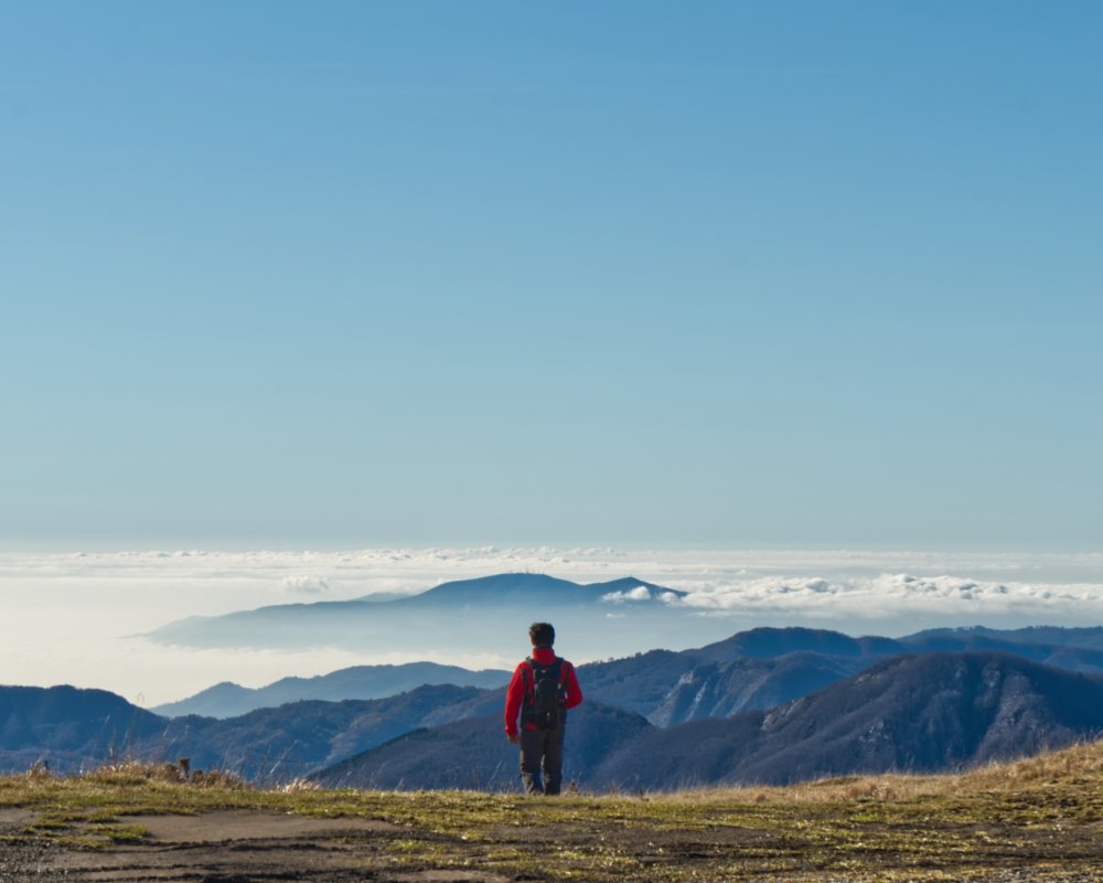
The fifteenth section of the Romea Nonantolana Longobarda starts from the Capanno Tassoni refuge, on the Modenese side of the Tuscan-Emilian Apennines. After 2.5km of climbing, you reach the Croce Arcana Pass and set foot in Tuscany. The Pass, which peaks at 1,669 metres above sea level, is a spectacular, 360-degree vantage point; once over it, the path takes you – mainly downhill – towards the Val di Lima. The first Tuscan village that you come across is Doganaccia, famous as one of the Pistoiese mountain ski resorts.
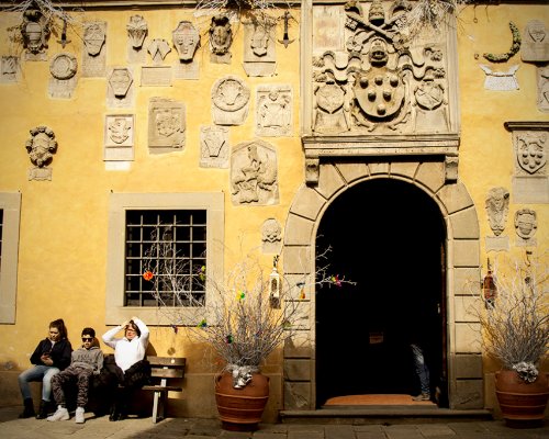
The path through the woods, which sometimes overlaps with the mushroom trail (funghi being the pride of this area), leads to Cutigliano. Walking through the village’s historic centre, one cannot fail to be impressed by the Palazzo dei Capitani della Montagna, with its façade speckled with stone and terracotta coats-of-arms, nor by the church of the Madonna di Piazza. A little away from the centre, meanwhile, is the church of San Bartolomeo, which marks the end of this leg of the Romea Strata.
The fifteenth section of the Romea Nonantolana Longobarda starts from the Capanno Tassoni refuge, on the Modenese side of the Tuscan-Emilian Apennines. After 2.5km of climbing, you reach the Croce Arcana Pass and set foot in Tuscany. The Pass, which peaks at 1,669 metres above sea level, is a spectacular, 360-degree vantage point; once over it, the path takes you – mainly downhill – towards the Val di Lima. The first Tuscan village that you come across is Doganaccia, famous as one of the Pistoiese mountain ski resorts.
The path through the woods, which sometimes overlaps with the mushroom trail (funghi being the pride of this area), leads to Cutigliano. Walking through the village’s historic centre, one cannot fail to be impressed by the Palazzo dei Capitani della Montagna, with its façade speckled with stone and terracotta coats-of-arms, nor by the church of the Madonna di Piazza. A little away from the centre, meanwhile, is the church of San Bartolomeo, which marks the end of this leg of the Romea Strata.
- straighten
Length13,5 Km
-
DifficultyAverage
- trending_down
Descent1034 m
- trending_up
Ascent410 m
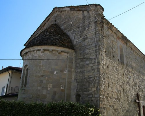
The sixteenth section of the Romea Strata takes you into the heart of the Pistoiese mountains, with the Apennine woods and watercourses keeping you company. Every so often, the route offers the chance to discover one of the little mountain villages that make up the municipal area of San Marcello Piteglio. The first you come to are Pratale and Lizzano Pistoiese, and then San Marcello Pistoiese, where you should pause to have a look at the church of Santa Caterina, which stands along the route.
Leaving San Marcello Pistoiese behind you, you head on for a few kilometres on an asphalt road, and then find yourself walking along an old railway that once went to Gavinana, but which now serves as a cycle route. Once at Gavinana, you should allow yourself a wander around the town centre, especially for the sake of the church of Santa Maria Assunta. It is also worth visiting Palazzo Achilli, an historic building that is now the information centre for the Ecomuseo della Montagna Pistoiese network, and which also puts on temporary exhibitions. Other villages on the route include Maresca, where you find (a little off the beaten track) the Papini Foundry, which, dating back to 1400, is oldest foundry in Tuscany, and also a constituent of the Ecomuseo.
Towards the end of the section, you meet the village of Campo Tizzoro and, along the banks of the Maresca stream, the little town of Pontepetri. Follow the path of the Ghiacciaia (ice house) along the river Reno, and you will arrive at the Antica Locanda Le Panche, which marks the end of the section.
- straighten
Length23,1 Km
-
DifficultyAverage
- trending_down
Descent644 m
- trending_up
Ascent634 m
After a brief climb, you start to descend – though not without a few more uphill moments – towards Pistoia, which lies at the feet of the Pistoiese mountains. From Pontepetri, which stands at 697 metres above sea level, you drop to 74 by the end of this section, which again involves thick clumps of woodland. You will tread a variety of terrain, dirt paths, gravel roads and different types of asphalt. Cerchiaio and Castel di Piazza are two typical villages that you will find along the way.
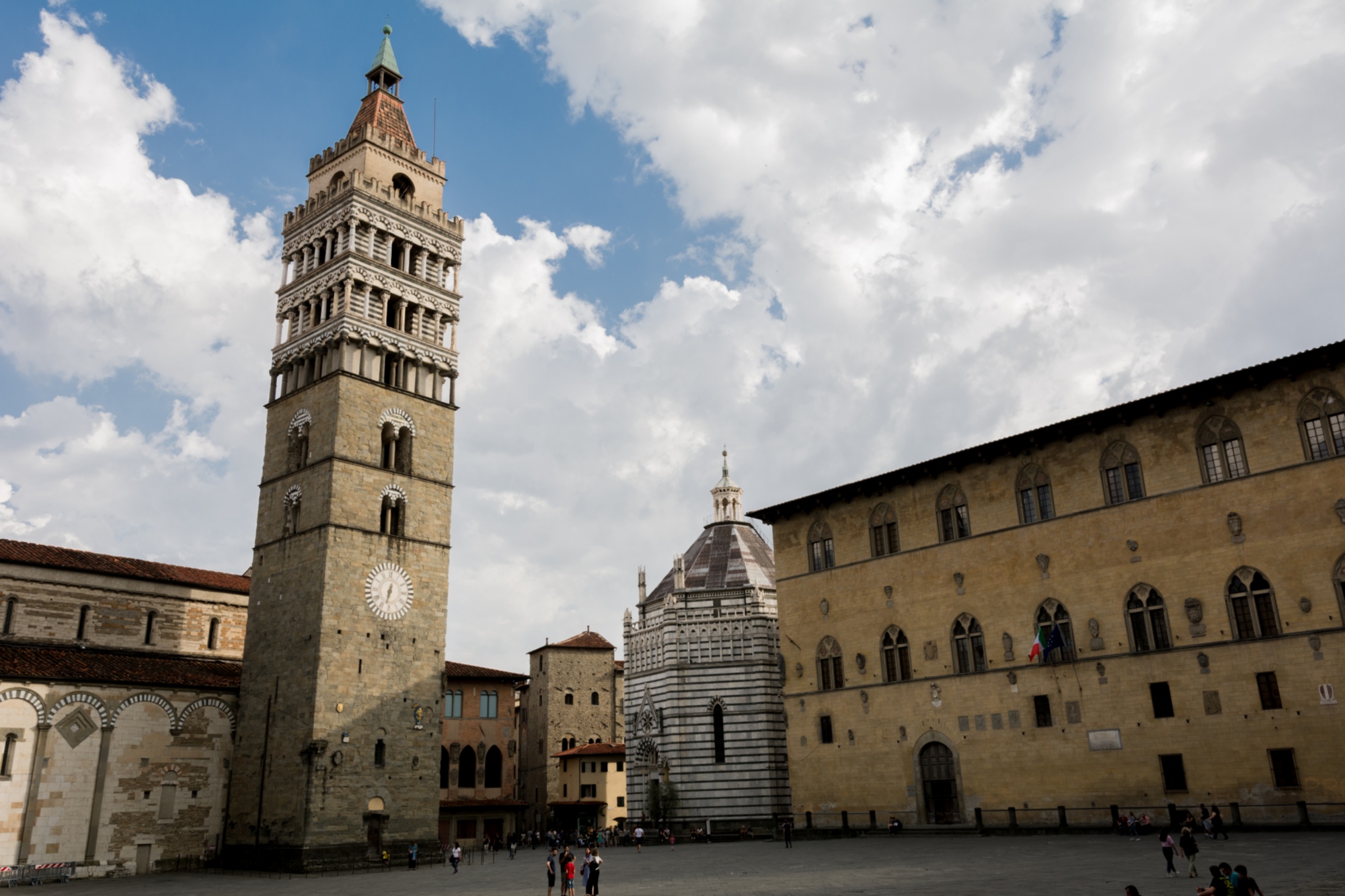
Once down on the plain, you will have the Ombrone Pistoiese stream, a tributary of the Arno, to accompany you for a few kilometres, right up to your entrance into Pistoia. The section concludes in the beautiful Piazza Duomo, and the sights that surround you will leave you breathless. These include the Cathedral of San Zeno, home to the relics of San Giacomo and San Bartolomeo, the Baptistery of San Giovanni in Corte and the Palazzo del Comune, which is now used as the Civic Museum.
After a brief climb, you start to descend – though not without a few more uphill moments – towards Pistoia, which lies at the feet of the Pistoiese mountains. From Pontepetri, which stands at 697 metres above sea level, you drop to 74 by the end of this section, which again involves thick clumps of woodland. You will tread a variety of terrain, dirt paths, gravel roads and different types of asphalt. Cerchiaio and Castel di Piazza are two typical villages that you will find along the way.
Once down on the plain, you will have the Ombrone Pistoiese stream, a tributary of the Arno, to accompany you for a few kilometres, right up to your entrance into Pistoia. The section concludes in the beautiful Piazza Duomo, and the sights that surround you will leave you breathless. These include the Cathedral of San Zeno, home to the relics of San Giacomo and San Bartolomeo, the Baptistery of San Giovanni in Corte and the Palazzo del Comune, which is now used as the Civic Museum.
- straighten
Length18,1 Km
-
DifficultyAverage
- trending_down
Descent864 m
- trending_up
Ascent262 m
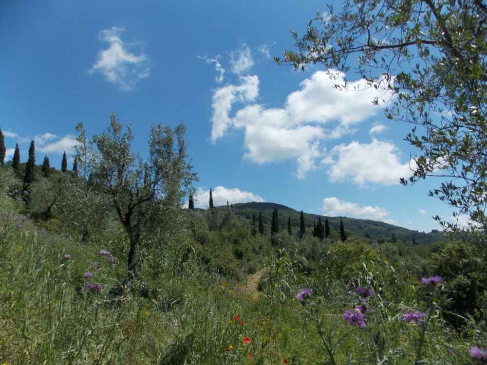
This long, straight section takes you to Pontelungo, a hamlet in the municipality of Pistoia, where you will meet the Ombrone Pistoiese again. Here, the route bends left to point towards the slopes of Montalbano; indeed, after a few kilometres, the path starts to curve upwards, and you soon find yourself once again surrounded by greenery, among the woods, vineyards and olive groves that characterise the Montalbano hills. On the first slope, in the vicinity of Collina, you will find the church of San Pietro and San Girolamo, built in the 1990s to the designs of architect Giovanni Michelucci, on the site of a medieval church that was destroyed during the Second World War.
After nine kilometres or so, not long after the ruins of the convent of the Madonna delle Grazie, you come to CAI path 300, which runs along the whole Montalbano ridge and accounts for multiple sections of the Romea Strata. This one finishes in front of the church of San Baranto, in the town of the same name, which falls within the municipality of Lamporecchio, famous as a natural vantage point over the surrounding plain.
- straighten
Length18,7 Km
-
DifficultyDemanding
- trending_down
Descent407 m
- trending_up
Ascent673 m
From San Baronto the route enters the trees and you again find yourself cresting Montalbano until you reach Torre Sant’Alluccio. Soon after that, you break off from the ridge and start descending into the valley, with sinuous hills on either side.
Along the way you will find Anchiano, a minute village that somehow gave birth to Leonardo da Vinci. The birthplace of the genius and the adjacent farmhouse have been converted into a museum, which among other things boasts a high-definition digital reproduction of The Last Supper. Once you’ve drunk your fill of this magical place, the descent continues on the Strada Verde, a path some three kilometres long that connects Anchiano to Vinci. On the way, you cannot but notice the distant Conti Guidi Castle and the bell tower of the church of Santa Croce, eternal features of the Vinci skyline.
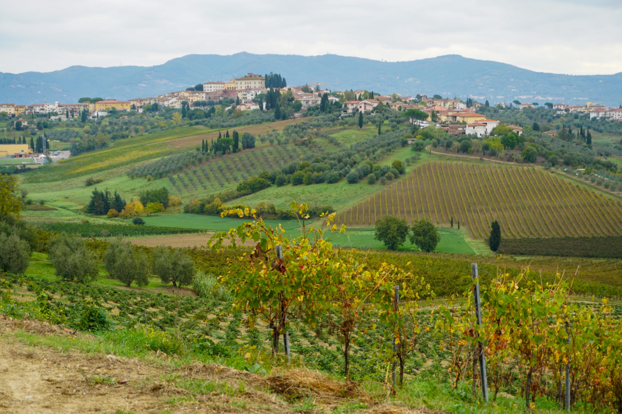
17 kilometres into the section, you stumble upon the hilltop village of Cerreto Guidi, surrounded by vines and olive groves as far as the eye can see. Cerreto is home to one of the 12 Medici villas that have been UNESCO World Heritage Sites since 2013.
The section wraps up in Fucecchio, the confluence of the Romea Strata and the Via Francigena. The precise bookend of the section is Piazza Vittorio Veneto, in the old part of the town, where you can admire the great fresco of Saint Christopher, patron saint of pilgrims, painted on the palazzo’s façade. The College of San Giovanni Battista is found in the same piazza.
From San Baronto the route enters the trees and you again find yourself cresting Montalbano until you reach Torre Sant’Alluccio. Soon after that, you break off from the ridge and start descending into the valley, with sinuous hills on either side.
Along the way you will find Anchiano, a minute village that somehow gave birth to Leonardo da Vinci. The birthplace of the genius and the adjacent farmhouse have been converted into a museum, which among other things boasts a high-definition digital reproduction of The Last Supper. Once you’ve drunk your fill of this magical place, the descent continues on the Strada Verde, a path some three kilometres long that connects Anchiano to Vinci. On the way, you cannot but notice the distant Conti Guidi Castle and the bell tower of the church of Santa Croce, eternal features of the Vinci skyline.
17 kilometres into the section, you stumble upon the hilltop village of Cerreto Guidi, surrounded by vines and olive groves as far as the eye can see. Cerreto is home to one of the 12 Medici villas that have been UNESCO World Heritage Sites since 2013.
The section wraps up in Fucecchio, the confluence of the Romea Strata and the Via Francigena. The precise bookend of the section is Piazza Vittorio Veneto, in the old part of the town, where you can admire the great fresco of Saint Christopher, patron saint of pilgrims, painted on the palazzo’s façade. The College of San Giovanni Battista is found in the same piazza.
- straighten
Length26,1 Km
-
DifficultyAverage
- trending_down
Descent744 m
- trending_up
Ascent435 m
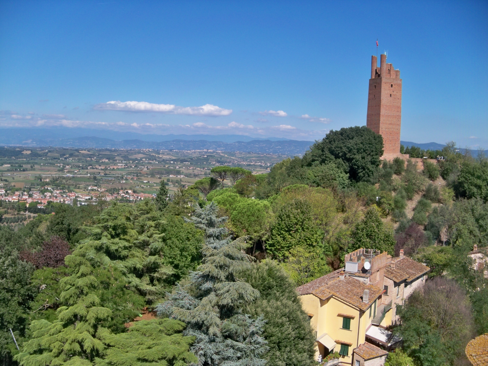
Section 20 of the Romea Strata adheres entirely to the Via Francigena on its way to San Miniato. The 10km to here from Fucecchio are among the flattest on the route, but finish with a climb from San Miniato Basso to the upper (and older) part of the town, which is dominated by the imposing fortress built by Frederick II.
Other sites not to be missed are the Cathedral of Santa Maria Assunta and San Genesio, and the distinctive bell tower known as the Tower of Matilde.
- straighten
Length9,7 km
-
DifficultyEasy
- trending_down
Descent27 m
- trending_up
Ascent133 m
More info

You will find further details on the website romeastrata.it on the sections unique to the Romea Nonantolana-Longobarda, which runs into Tuscany, and also on the other sections that make up the five routes across north-east Italy.