A long itinerary through the beaches and Mediterranean scrub on the Argentario
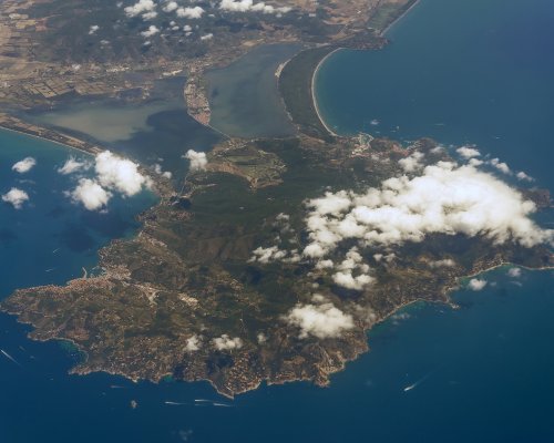
Looking out over the clear waters of the Tyrrhenian Sea, the Argentario Promontory sits imposingly beyond the Orbetello Lagoon. In Antiquity, this place of impassable high plains was an island detached from the rest of Tuscany, but over the centuries, the rising of the Feniglia and Giannella tombolos transformed the Argentario into a promontory connected to the mainland. Between the two strips of land is the Orbetello Lagoon, one of the most important lagoon ecosystems in central Italy.
Only two towns can be found on the coast of the Argentario: Porto Santo Stefano, a village with a long maritime tradition and capital of the municipality of Monte Argentario, and Porto Ercole, an ancient Etruscan village on the southern coast.
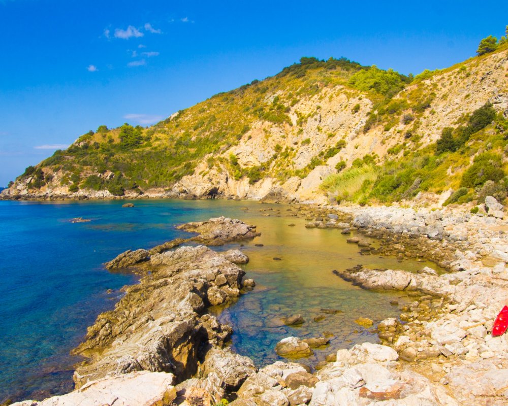
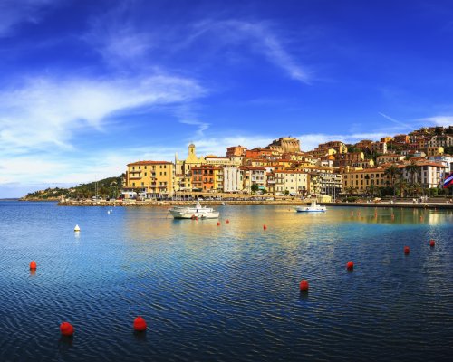
Porto Santo Stefano, dominated by the elegant Fortezza Spagnola, built between the 16th and 17th centuries, has been inhabited since Roman times. After a thriving period of development in the 1500s, the village was heavily damaged during the Second World War by Allied bombings: for this reason, the town centre is almost entirely new. Porto Santo Stefano is more than just summer tourism and evening strolls on the boardwalk: leaving the town centre, you can explore one of the many coves that dot the promontory, each with a different shape, from the sandy Giannella tombolo to the rocky Cala del Gesso and Cala Grande.
Traces of the past are still visible in Porto Ercole, on the other hand, which is included in the list of the Most Beautiful Villages in Italy. After the port was developed in the Roman era, the small town grew before becoming fortified in the Middle Ages, and finally being placed under control of the Republic of Siena in the 15th century. The strategic use of the small port is highlighted by the many forts throughout the area, from the 15th-century Forte Filippo to Forte Santa Caterina, built 200 years later, and the colossal medieval fortress that was enlarged during the period of Sienese control. Just as the Giannella sits opposite Porto Santo Stefano, the Feniglia tombolo leads to Porto Ercole, with its dense pine forest. It’s wonderful to see the deer as they walk by, hidden behind the leafy branches just a short walk from the beach.
And so we start our hike through the high plains of the Argentario, from Poggio Fornacelle to the Cala Mar Morto, exploring the lush, green ridges before diving into the crystal-clear waters that surround the promontory.
We begin our journey at the San Pietro climb, about five kilometres from the centre of Porto Santo Stefano, where the city’s cemetery is located. We take a stretch on the left that leads down a dirt road. At the first fork, take a left, along a street that offers a splendid view of the island of Giannutri in the distance. Poggio Pinzo is on the right and Poggio Vongher on the left. Continuing for another two kilometres, we’ll come to a downhill trail on the right, at the end of which is the Trivio dell’Olmo, our first stop.
We begin our journey at the San Pietro climb, about five kilometres from the centre of Porto Santo Stefano, where the city’s cemetery is located. We take a stretch on the left that leads down a dirt road. At the first fork, take a left, along a street that offers a splendid view of the island of Giannutri in the distance. Poggio Pinzo is on the right and Poggio Vongher on the left. Continuing for another two kilometres, we’ll come to a downhill trail on the right, at the end of which is the Trivio dell’Olmo, our first stop.
Following the directions for the Sguazzatoio, we’ll arrive at the namesake fort, where we can find a votive niche dedicated to the Virgin Mary. Continue for another two kilometres through rolling hills that wind through the shrub-like vegetation typical in this part of the Argentario. We’ll eventually come to the Fonte del Romito, a place boasting the ideal microclimate: tepid in the winter and cool in the summer. This is the perfect place for finding a bit of rest on hot days. Continuing our hike, we follow a path that merges with a cement road lined with majestic fruit trees. Keep to the left as we move downhill to the Muflone Valley, then head the right. We’re now close to Cannelle: on the namesake beach is a centuries-old Spanish tower, to the left of the bay. With its pebbles and fine sand, Cannelle Beach is a favourite destination for surfers.
Following the directions for the Sguazzatoio, we’ll arrive at the namesake fort, where we can find a votive niche dedicated to the Virgin Mary. Continue for another two kilometres through rolling hills that wind through the shrub-like vegetation typical in this part of the Argentario. We’ll eventually come to the Fonte del Romito, a place boasting the ideal microclimate: tepid in the winter and cool in the summer. This is the perfect place for finding a bit of rest on hot days. Continuing our hike, we follow a path that merges with a cement road lined with majestic fruit trees. Keep to the left as we move downhill to the Muflone Valley, then head the right. We’re now close to Cannelle: on the namesake beach is a centuries-old Spanish tower, to the left of the bay. With its pebbles and fine sand, Cannelle Beach is a favourite destination for surfers.
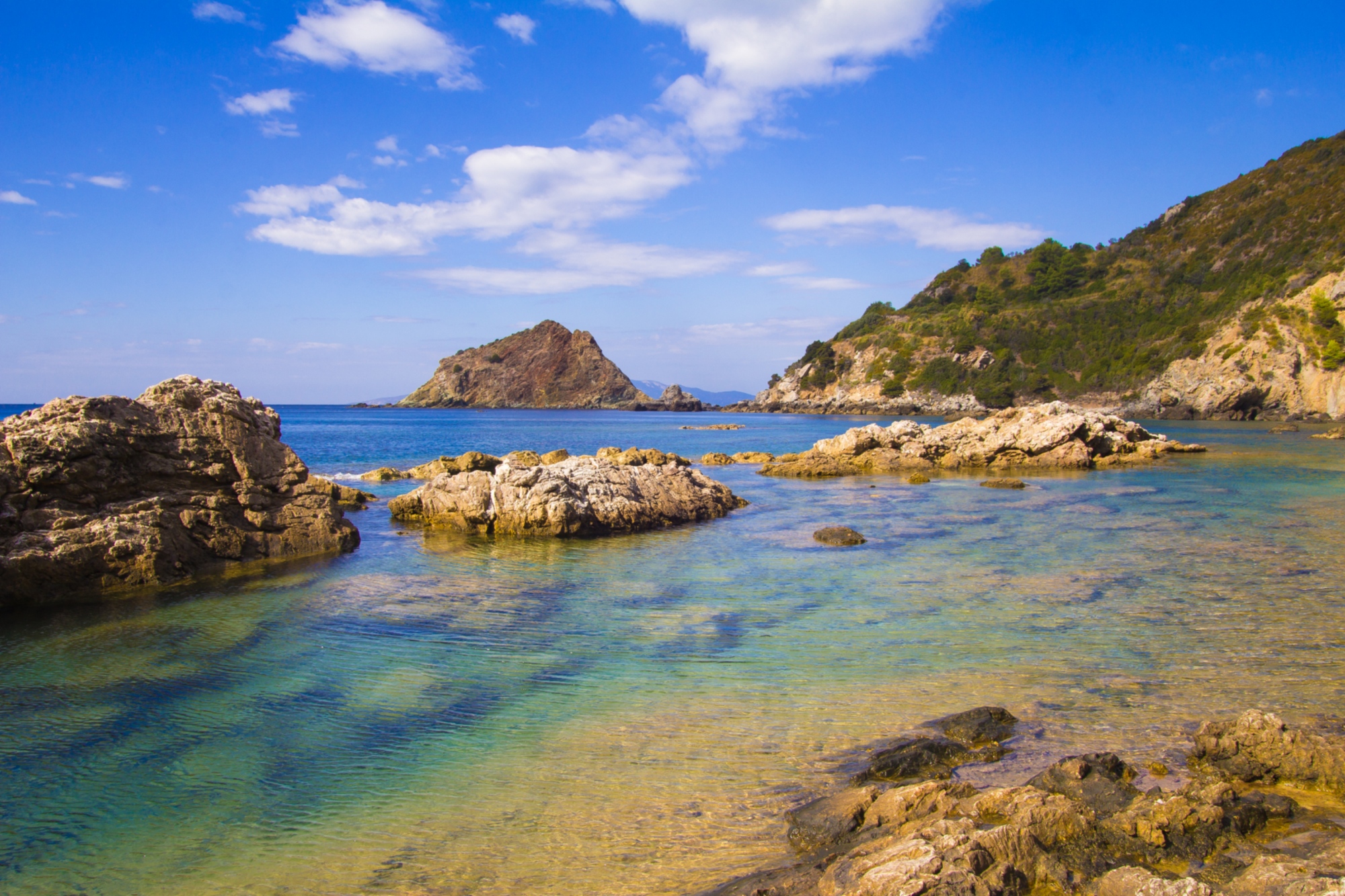
From Cannelle, let’s go west on a narrow asphalt road that leads to the Mar Morto, one of the wildest coves in the Argentario. Its name comes from an evocative barrier of cliffs that create small natural pools where the water is always calm. Diving into the crystal-clear waters, you can admire the most fascinating seabed of the entire promontory, inhabited by a great many fish. After exploring all the nooks and crannies of the Mar Morto, head back along the road that dominates the Cannelle, continuing on an uphill stretch of the Fosso del Morto. Keeping Poggio Paladino on our left, we’ll pick up the trail we took just a few hundred kilometres from the Trivio dell’Olmo. From here, we can follow the route backwards to return to the starting point.
From Cannelle, let’s go west on a narrow asphalt road that leads to the Mar Morto, one of the wildest coves in the Argentario. Its name comes from an evocative barrier of cliffs that create small natural pools where the water is always calm. Diving into the crystal-clear waters, you can admire the most fascinating seabed of the entire promontory, inhabited by a great many fish. After exploring all the nooks and crannies of the Mar Morto, head back along the road that dominates the Cannelle, continuing on an uphill stretch of the Fosso del Morto. Keeping Poggio Paladino on our left, we’ll pick up the trail we took just a few hundred kilometres from the Trivio dell’Olmo. From here, we can follow the route backwards to return to the starting point.